
{"cover":"Professional landscape format (1536×1024) hero image featuring bold text overlay 'Democratizing Reality Capture: Affordable Tools Empowering Small Surveying Firms in 2026' in extra large 72pt white sans-serif font with dark shadow and semi-transparent navy blue overlay box, positioned in upper third center. Background shows small surveying team using affordable handheld LiDAR scanner and consumer drone on construction site, with 3D point cloud visualization overlay on tablet screen. Split composition showing traditional surveying equipment on left versus modern affordable reality capture tools on right. Color scheme: deep blue, white, orange accents for technology elements. High contrast, magazine cover quality, editorial style with professional photography aesthetic demonstrating technology accessibility and democratization theme.","content":["Detailed landscape format (1536×1024) image showing comparison infographic of reality capture technology costs from 2020 to 2026, featuring bar chart with dramatic downward price trend from $50,000+ to under $5,000. Visual elements include icons of affordable surveying tools: consumer drones with cameras, smartphone-based LiDAR scanners, handheld reality capture devices, and budget-friendly terrestrial scanners. Split screen showing solo surveyor using compact equipment on left versus large firm's expensive traditional setup on right. Include price tags, percentage decrease annotations, and 'accessibility breakthrough' badge. Clean, modern infographic style with blue and green color palette, professional data visualization aesthetic, technology democratization theme prominent throughout composition.","Detailed landscape format (1536×1024) image depicting cloud-based collaboration workflow for small surveying firms, showing multiple screens and devices connected via cloud icon in center. Visual elements include laptop displaying 3D point cloud data, tablet with mobile mapping interface, smartphone with field data collection app, and desktop monitor showing AI-powered analysis dashboard. Arrows indicating real-time data flow between devices and stakeholders. Include visual representations of automation: machine learning algorithms processing survey data, automated change detection overlays, and pattern recognition highlights. Color scheme: white background with blue cloud infrastructure, green data flow lines, orange AI accent elements. Modern, clean technology illustration style emphasizing interoperability and user-friendly interfaces for small firms.","Detailed landscape format (1536×1024) image showing before-and-after case study comparison of small surveying firm capabilities. Left side labeled 'Traditional Methods 2020' shows surveyor with basic equipment, paper documents, and limited deliverables. Right side labeled 'Reality Capture 2026' shows same small firm delivering comprehensive 3D site documentation, digital twins, immersive visualizations on multiple devices. Center displays competitive advantage elements: faster turnaround time clock, enhanced accuracy badge, improved safety icon, and client satisfaction rating. Include visual metrics showing project timeline reduction, cost savings percentages, and market differentiation indicators. Bottom section shows diverse client types receiving rich digital deliverables. Professional business infographic style with blue, green, and white color scheme, success story aesthetic demonstrating leveled playing field against larger competitors."]
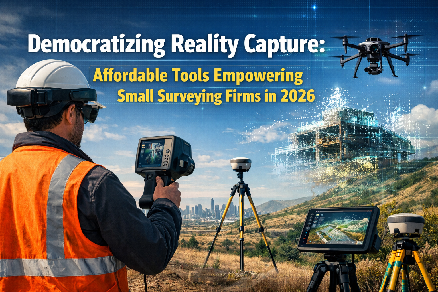
The surveying industry is experiencing a seismic shift. What was once the exclusive domain of well-funded corporations with six-figure equipment budgets has transformed into an accessible playing field where solo practitioners and small firms can compete head-to-head with industry giants. Democratizing Reality Capture: Affordable Tools Empowering Small Surveying Firms in 2026 represents more than just a technological evolution—it's a fundamental restructuring of who can deliver cutting-edge 3D site documentation, immersive visualizations, and comprehensive digital deliverables.
Just five years ago, reality capture technology required specialized expertise, bulky equipment, and investments exceeding $50,000. Today, user-friendly applications and hardware priced under $5,000 enable individual surveyors to capture millimeter-accurate 3D data using tools that fit in a backpack. This transformation is leveling the competitive landscape and creating unprecedented opportunities for smaller operations willing to embrace these accessible technologies.
According to industry experts, reality capture has officially gone mainstream as the defining trend of 2026, with adoption expanding dramatically as specialized services transition to increasingly accessible toolsets.[2] The barrier to entry has collapsed, and the competitive advantages once reserved for large firms are now available to anyone with modest capital investment and willingness to learn.
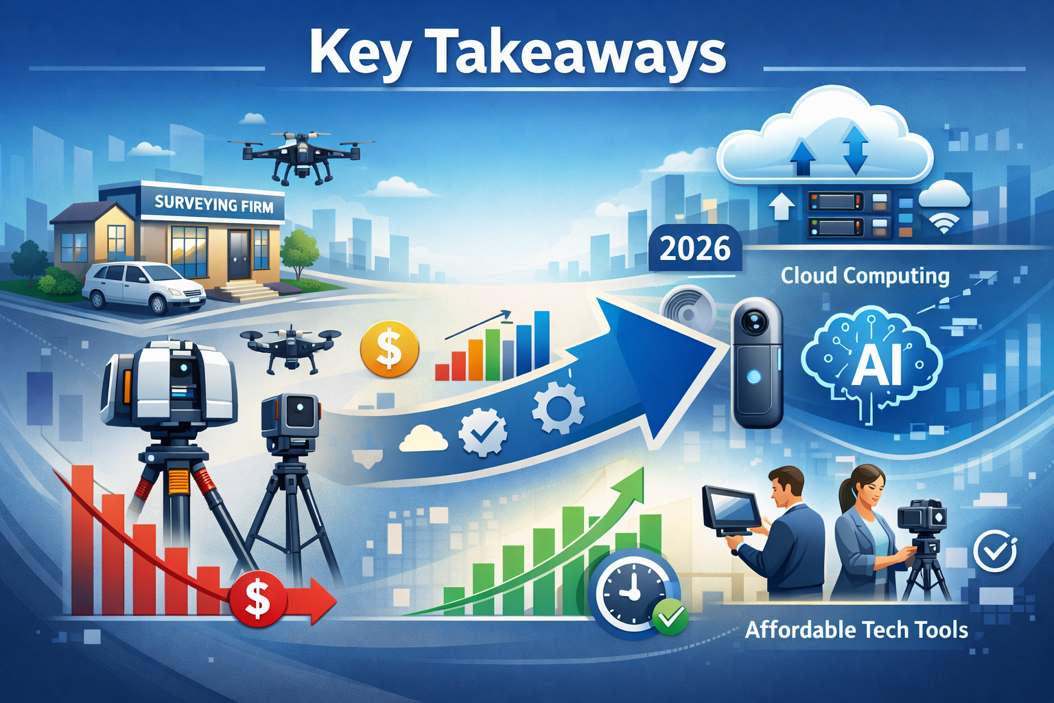
Key Takeaways
- Affordable hardware revolution: Consumer drones, smartphone-based LiDAR, and handheld scanners under $5,000 now deliver professional-grade reality capture previously requiring $50,000+ equipment investments
- User-friendly software platforms: Cloud-based processing and AI-powered automation eliminate the need for specialized technical expertise, enabling small firms to deploy reality capture without hiring additional specialists
- Competitive market differentiation: Small surveying firms integrating reality capture into core service offerings can now compete directly with larger competitors by delivering rich digital deliverables clients increasingly expect as standard
- Multi-technology integration: Combining affordable drones, mobile mapping, and terrestrial scanning with AI-driven analysis creates comprehensive datasets that rival outputs from expensive enterprise systems
- Client expectation shift: The market now demands 3D models, point clouds, and immersive visualizations as baseline deliverables rather than premium services, creating urgency for adoption across all firm sizes
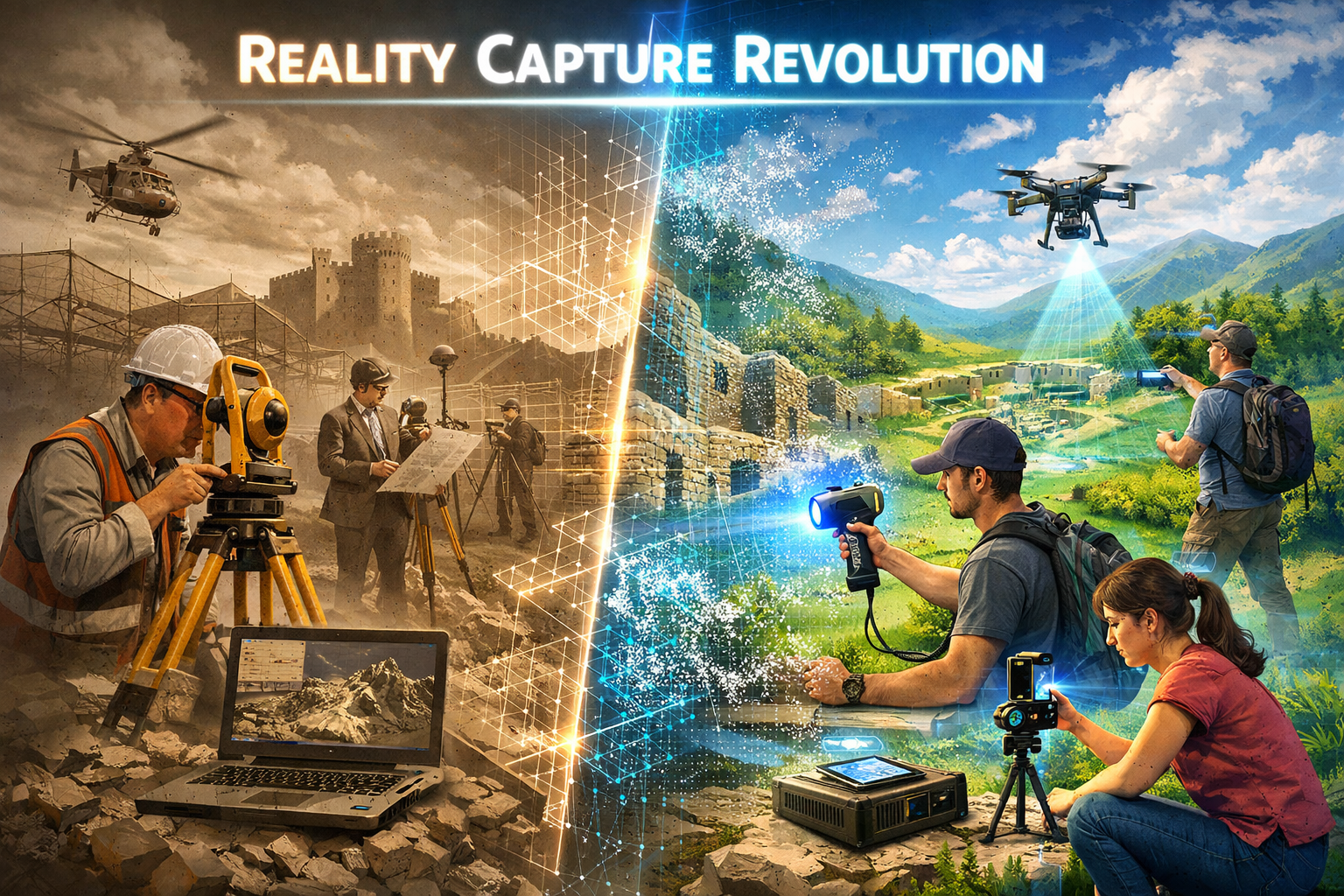
The Reality Capture Revolution: From Elite Service to Mainstream Tool
Understanding Reality Capture Technology
Reality capture refers to the process of digitally documenting physical environments using various technologies including laser scanning, photogrammetry, LiDAR (Light Detection and Ranging), and mobile mapping systems. These technologies create highly accurate 3D representations of buildings, infrastructure, terrain, and construction sites that can be measured, analyzed, and shared digitally.
The fundamental value proposition remains consistent regardless of firm size: enhanced precision, improved safety outcomes, and accelerated project timelines.[2] What has changed dramatically is the accessibility of tools capable of delivering these benefits.
Traditional surveying methods required physical presence at every measurement point, extensive manual calculations, and time-consuming data compilation. Reality capture transforms this workflow by enabling surveyors to collect millions of data points in minutes, process them through automated algorithms, and deliver comprehensive digital models that clients can explore interactively.
The Affordability Breakthrough of 2026
The cost barrier that historically excluded small firms from reality capture has collapsed. Arnaud Lezennec, senior applications expert at Trimble, stated that "Reality capture technology is already invaluable, but it will become even more democratized in 2026."[2] This prediction has materialized through several concurrent developments:
Hardware price compression has been dramatic. Unmanned aerial vehicles (UAVs) equipped with high-resolution cameras and LiDAR sensors have transitioned from expensive, inaccessible tools to cheaper and much more accessible options, becoming standard for surveying tasks across the industry.[1] Entry-level professional drones with photogrammetry capabilities now retail for under $2,000, while smartphone-based LiDAR scanners leverage built-in sensors on consumer devices costing a fraction of dedicated equipment.
Software democratization has followed a similar trajectory. Cloud-based processing platforms offer subscription models starting at $50-100 monthly, eliminating the need for expensive workstations and perpetual software licenses. These platforms handle computationally intensive tasks like point cloud processing and 3D model generation on remote servers, making professional-grade outputs accessible from standard laptops.
Educational resources have proliferated through online tutorials, manufacturer training programs, and professional development courses specifically designed for small firm adoption. The learning curve that once required months of specialized training has compressed to weeks of focused practice with user-friendly interfaces.
This convergence of affordable hardware, accessible software, and available training has created what industry observers call the "democratization moment" for reality capture technology.
Market Forces Driving Adoption
Client expectations have fundamentally shifted. What clients once viewed as impressive premium deliverables—3D models, virtual walkthroughs, comprehensive point cloud data—they now increasingly expect as standard practice.[2] This expectation creates both competitive pressure and market opportunity.
Small firms that adopt reality capture can differentiate themselves in local markets previously dominated by larger competitors. The ability to deliver comprehensive visual documentation, precise measurements extracted from 3D models, and immersive client presentations creates tangible value that justifies premium pricing or wins competitive bids.
Construction projects, infrastructure assessments, and commercial building surveys increasingly require digital documentation for building information modeling (BIM) integration, progress monitoring, and as-built verification. Firms unable to provide these deliverables risk exclusion from growing project categories.
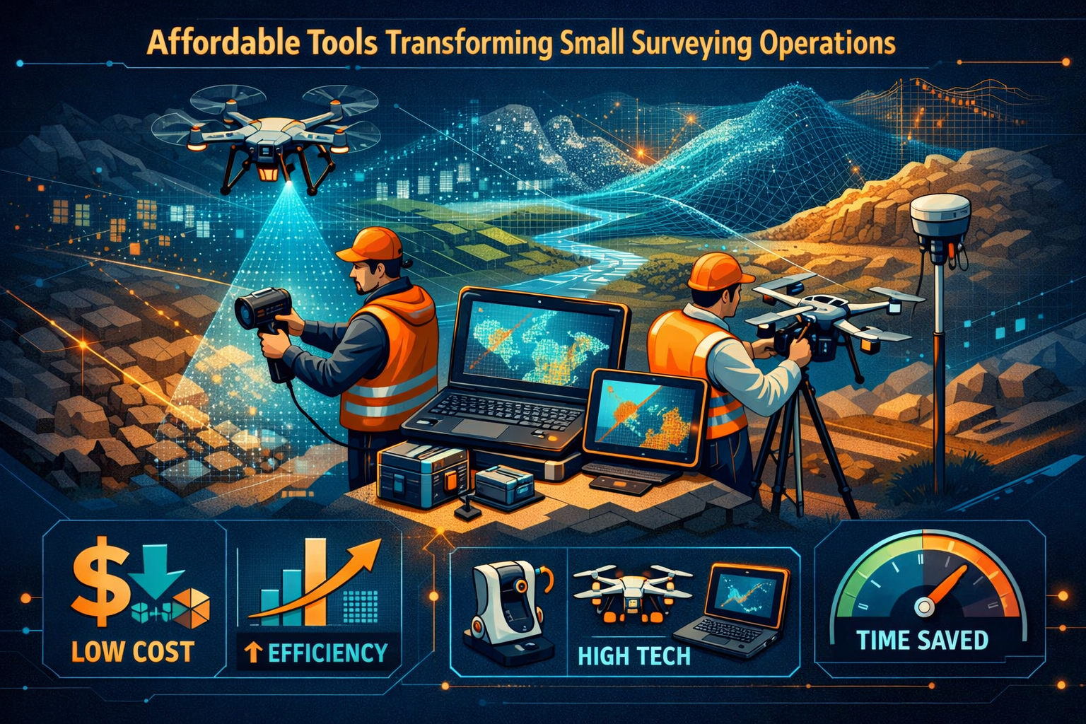
Affordable Tools Transforming Small Surveying Operations
Consumer Drones: Aerial Perspective for Everyone
The drone revolution has been particularly transformative for small surveying firms. Modern consumer and prosumer drones equipped with high-resolution cameras enable photogrammetric surveys that generate accurate 3D models and orthomosaic maps at a fraction of traditional aerial survey costs.
DJI Mavic 3 Enterprise and similar platforms priced between $3,000-$5,000 offer RTK (Real-Time Kinematic) positioning for centimeter-level accuracy without ground control points. These compact systems fit in standard backpacks, deploy in minutes, and capture comprehensive site data in single flights lasting 30-40 minutes.
The workflow simplicity is remarkable: 📱 Plan the flight using automated mission planning apps, execute the autonomous flight while monitoring from ground level, upload imagery to cloud processing platforms, and receive deliverables including 3D models, elevation maps, and volumetric calculations within hours.
For topographic surveys, drones have become indispensable tools enabling small firms to survey large properties efficiently. What previously required days of manual measurements with total stations now completes in hours with superior data density and visual documentation.
Smartphone-Based LiDAR: Professional Scanning in Your Pocket
The integration of LiDAR sensors into consumer smartphones represents perhaps the most accessible entry point to reality capture. Devices like iPhone Pro models and iPad Pro tablets include solid-state LiDAR scanners capable of capturing indoor spaces with surprising accuracy.
Applications like Polycam, 3D Scanner App, and Canvas leverage these built-in sensors to create detailed 3D models suitable for preliminary assessments, space planning, and documentation. While not matching the precision of dedicated terrestrial laser scanners, smartphone-based scanning delivers sufficient accuracy for many surveying applications at essentially zero additional hardware cost for firms already using these devices.
The practical applications for small surveying firms are extensive:
- Interior documentation for building surveys and renovation planning
- Quick site assessments before deploying more specialized equipment
- Client presentations showing existing conditions and proposed modifications
- Preliminary measurements for estimating and proposal development
- As-built verification for smaller interior spaces and building components
The speed advantage is compelling. A single surveyor can capture a residential interior in 15-20 minutes, process the scan on-device or via cloud upload, and share measurements and visualizations with clients the same day.
Handheld Mobile Mapping Systems
Handheld mobile mapping systems represent the middle ground between smartphone convenience and terrestrial scanner precision. Devices like the GeoSLAM ZEB series, NavVis VLX, and emerging budget alternatives priced between $3,000-$8,000 enable surveyors to create detailed 3D models from diverse indoor and outdoor environments without bulky equipment or lengthy processing delays.[1]
These systems use SLAM (Simultaneous Localization and Mapping) technology to build coherent 3D models while the operator walks through spaces. The workflow is remarkably simple: power on the device, walk through the area at normal pace, and let the system automatically capture millions of points and align them into comprehensive models.
Key advantages for small firms include:
- ⚡ Rapid deployment: No setup time or tripod positioning required
- 🏗️ Complex environment capability: Stairs, cluttered spaces, and multi-level buildings pose no obstacles
- 👤 Single-operator efficiency: One person completes surveys requiring multi-person teams with traditional methods
- 📊 Comprehensive coverage: Continuous scanning captures details easily missed with static setups
- 💼 Portability: Lightweight systems enable surveyors to cover multiple sites daily
For firms conducting property surveys, mobile mapping systems dramatically increase productivity while delivering richer documentation than traditional measurement methods.
Budget-Friendly Terrestrial Laser Scanners
While high-end terrestrial laser scanners still command prices exceeding $50,000, emerging budget options from manufacturers like Leica BLK series, Faro Focus, and Trimble X7 offer capable performance at $15,000-$25,000 price points. For small firms, even these represent significant investments, but financing options and the revenue potential from expanded service offerings often justify the expense.
More accessible still are refurbished and previous-generation scanners available through secondary markets at $8,000-$12,000. These systems may lack the latest features but deliver professional-grade accuracy suitable for most surveying applications.
The strategic consideration for small firms centers on utilization rates. A scanner generating just two additional projects monthly at $2,000-$3,000 premium pricing pays for itself within a year while differentiating the firm's capabilities in competitive markets.
Cloud Computing and AI: The Great Equalizers
Processing Power Without Capital Investment
Cloud-based processing platforms have eliminated one of reality capture's most significant barriers: the need for expensive workstations with high-end graphics cards and processors. Services like Pix4D Cloud, DroneDeploy, ReCap Pro, and Metashape Cloud handle computationally intensive photogrammetry and point cloud processing on remote servers.
The subscription economics favor small firms. Rather than $5,000-$10,000 upfront for capable workstations plus ongoing upgrade cycles, cloud platforms charge $50-$200 monthly based on processing volume. This transforms capital expenditure into operational expense, improving cash flow and reducing financial risk.
Processing workflows that once required overnight rendering now complete in hours. Upload drone imagery or scan data, select processing parameters through intuitive interfaces, and receive deliverables including:
- 📐 3D mesh models with photorealistic textures
- 🗺️ Orthomosaic maps with georeferenced accuracy
- 📊 Digital elevation models (DEMs) and digital surface models (DSMs)
- 📏 Point clouds with classified elements
- 📈 Volumetric calculations and change detection analysis
The quality outputs rival those from expensive local processing, democratizing access to professional-grade deliverables regardless of firm size or hardware budget.
AI-Powered Automation and Analysis
Artificial intelligence and machine learning algorithms are fundamentally reshaping reality capture workflows by automating labor-intensive tasks that previously required manual effort from surveying staff.[1] These capabilities particularly benefit small firms with limited personnel.
Automated feature extraction uses AI to identify and classify elements within point clouds: walls, windows, doors, utilities, vegetation, ground surfaces, and building components. What once required hours of manual classification now completes automatically with accuracy exceeding human consistency.
Change detection algorithms compare datasets from different time periods to identify modifications, settlement, deformation, or construction progress. For monitoring applications and construction surveys, this automation enables small firms to deliver sophisticated analysis without dedicated specialists.
Predictive analytics process massive datasets to identify patterns, detect anomalies, and predict future developments. Machine learning models trained on millions of building scans can flag potential structural issues, identify maintenance needs, and assess condition with increasing reliability.
The competitive implication is profound: small firms equipped with AI-enhanced platforms can deliver analysis and insights previously requiring large teams of specialists, leveling the playing field against better-resourced competitors.
Collaborative Platforms and Client Engagement
Cloud-based collaboration platforms enable real-time sharing and interaction with reality capture data across all stakeholder types.[2] This capability transforms how small surveying firms engage with clients, contractors, architects, and other project participants.
Platforms like Autodesk Construction Cloud, Trimble Connect, and Bentley iTwin allow surveyors to upload 3D models, point clouds, and related documentation to shared project environments. Stakeholders access data through web browsers without specialized software, exploring models, extracting measurements, and adding annotations collaboratively.
For small firms, these platforms provide enterprise-level collaboration capabilities without enterprise infrastructure costs. The professional presentation quality enhances perceived value and client satisfaction while streamlining communication and reducing coordination errors.
Client engagement benefits include:
- 🖥️ Interactive presentations: Clients explore 3D models rather than reviewing static plans
- 📱 Mobile accessibility: Project stakeholders review data from smartphones and tablets
- 💬 Annotation and markup: Collaborative commenting directly on 3D models
- 📂 Centralized documentation: All survey deliverables accessible from single platform
- 🔄 Version control: Automated tracking of data updates and revisions
This enhanced engagement often justifies premium pricing and generates referrals as clients appreciate the superior communication and documentation quality.
Democratizing Reality Capture: Implementation Strategies for Small Firms
Assessing Your Market and Service Opportunities
Before investing in reality capture technology, small surveying firms should conduct thorough market assessment to identify the most valuable opportunities within their specific service areas and client bases.
Client demand analysis begins with existing relationships. Survey current clients about their interest in 3D deliverables, digital documentation, and enhanced visualization. Many clients don't request these services simply because they're unaware of their availability or assume they're prohibitively expensive.
Competitive landscape evaluation examines what local and regional competitors offer. Markets where reality capture remains uncommon present differentiation opportunities, while saturated markets may require niche specialization or superior pricing to compete effectively.
Service category prioritization focuses initial adoption on applications with highest return potential:
- Construction progress monitoring: Regular drone surveys documenting project advancement
- As-built documentation: Comprehensive 3D records of completed projects
- Facility management: Digital twins for building owners and property managers
- Volumetric analysis: Stockpile measurements and earthwork calculations
- Renovation planning: Existing conditions documentation for building surveys
Different service categories favor different technology combinations. Aerial construction monitoring emphasizes drones, while interior renovation documentation prioritizes mobile mapping or terrestrial scanning.
Building Technical Competency Efficiently
The learning curve for reality capture technology has compressed dramatically, but small firms should still approach skill development strategically to maximize efficiency and minimize costly mistakes.
Manufacturer training programs offered by equipment vendors provide excellent starting points. DJI, Leica, Trimble, and other major manufacturers offer online courses, certification programs, and hands-on workshops specifically designed for surveying professionals. Many programs are free or low-cost, representing exceptional value.
Online learning platforms including YouTube tutorials, professional forums, and specialized training sites like The Geospatial Training Lab and Wingtra Academy offer comprehensive instruction at minimal cost. Dedicated practice following structured curricula accelerates competency development.
Peer networking through professional associations, online communities, and local surveying groups provides invaluable practical knowledge. Experienced practitioners often share workflow tips, processing parameters, and troubleshooting advice that dramatically shortens the learning process.
Phased implementation reduces risk and builds confidence progressively:
- Phase 1: Master basic data capture with entry-level equipment on low-risk projects
- Phase 2: Develop processing workflows and quality control procedures
- Phase 3: Expand service offerings and refine deliverable templates
- Phase 4: Integrate advanced features like AI analysis and multi-sensor fusion
This staged approach enables firms to generate revenue from reality capture services while continuing skill development, creating positive cash flow that funds further capability expansion.
Technology Selection and Investment Planning
Strategic technology selection matches equipment capabilities to specific service opportunities while managing financial risk appropriately for firm size and resources.
Entry-level configurations suitable for firms testing reality capture markets include:
| Technology | Example Products | Approximate Cost | Primary Applications |
|---|---|---|---|
| Consumer Drone | DJI Mini 3 Pro, Autel EVO Lite | $1,000-$2,000 | Aerial photography, basic photogrammetry |
| Smartphone LiDAR | iPhone/iPad Pro + Polycam | $0-$500 (app cost) | Interior scanning, quick assessments |
| Cloud Processing | Pix4D Cloud, DroneDeploy | $50-$150/month | Photogrammetry, orthomosaic generation |
| Total Initial Investment | $1,500-$3,000 | Multiple service categories |
This minimal configuration enables small firms to begin offering reality capture services, test market demand, and generate revenue before committing to larger investments.
Intermediate configurations for firms with established demand and revenue justification include:
| Technology | Example Products | Approximate Cost | Primary Applications |
|---|---|---|---|
| Professional Drone | DJI Mavic 3 Enterprise RTK | $4,000-$6,000 | High-accuracy surveys, large sites |
| Handheld Scanner | GeoSLAM ZEB Go, Leica BLK2GO | $4,000-$8,000 | Interior documentation, mobile mapping |
| Processing Software | ReCap Pro, Metashape Professional | $1,500-$3,000 | Advanced processing, local control |
| Total Investment | $9,500-$17,000 | Comprehensive service portfolio |
This configuration supports professional-grade deliverables competitive with larger firms while remaining accessible for small operations with modest capital availability.
Financing considerations include equipment leasing, subscription-based access through service providers, and phased acquisition spreading costs across multiple budget periods. Many firms find that revenue from initial projects funds subsequent equipment purchases, creating self-sustaining expansion.
Quality Control and Deliverable Standards
Professional credibility requires consistent quality and reliable deliverables. Small firms adopting reality capture must establish quality control procedures ensuring outputs meet professional standards and client expectations.
Accuracy verification protocols should include:
- ✅ Ground control points: Physical markers with known coordinates validating positional accuracy
- ✅ Check measurements: Comparing extracted dimensions against traditional survey measurements
- ✅ Redundant coverage: Ensuring adequate overlap in photogrammetry and complete coverage in scanning
- ✅ Registration verification: Confirming proper alignment when combining multiple datasets
- ✅ Metadata documentation: Recording equipment settings, environmental conditions, and processing parameters
Deliverable templates standardize outputs and streamline production. Developing reusable formats for common project types—topographic surveys, building documentation, construction monitoring—reduces processing time while ensuring consistent professional presentation.
Client communication protocols manage expectations regarding accuracy specifications, deliverable formats, and timeline requirements. Clear scope definition prevents misunderstandings and ensures clients receive appropriate data for their specific applications.
Professional standards from organizations like RICS (Royal Institution of Chartered Surveyors) and ASPRS (American Society for Photogrammetry and Remote Sensing) provide valuable guidance for establishing quality benchmarks and best practices.
Case Studies: Small Firms Winning with Affordable Reality Capture
Solo Practitioner Expands Services with $4,000 Investment
Background: A one-person surveying practice specializing in residential property surveys sought differentiation in a competitive local market dominated by established firms.
Implementation: The surveyor invested $4,200 in a DJI Mavic 3 drone and Pix4D Cloud subscription, completing online training over two weeks while practicing on personal properties and pro-bono community projects.
Results: Within six months, the practice added drone surveys to 40% of existing projects at $500-$800 premium pricing. New client acquisition increased 60% attributed to enhanced marketing materials featuring aerial imagery and 3D models. Total first-year revenue increase exceeded $28,000 against initial investment of $4,200 plus $600 annual subscription costs.
Key success factors: Starting with familiar project types (residential properties), leveraging enhanced deliverables for marketing differentiation, and focusing on client education about value rather than competing on price.
Three-Person Firm Competes for Municipal Contracts
Background: A small surveying firm previously excluded from municipal infrastructure projects due to limited capacity sought capability expansion without proportional staff increases.
Implementation: The firm invested $12,000 in handheld mobile mapping system (GeoSLAM ZEB Go) and terrestrial laser scanner (refurbished Leica P30), training two surveyors over one month while continuing regular operations.
Results: Successfully bid and won first municipal contract for comprehensive documentation of public facilities, delivering 3D models and floor plans for 15 buildings over three months. Contract value of $85,000 represented 40% increase over previous annual revenue. Subsequent contracts and expanded private-sector opportunities established reality capture as core service line generating 55% of firm revenue within 18 months.
Key success factors: Strategic equipment selection matching municipal requirements, phased training minimizing operational disruption, and leveraging initial success for marketing credibility in expanded markets.
Regional Firm Differentiates Through AI-Enhanced Analysis
Background: A five-person surveying firm faced increasing competition from larger regional competitors offering comprehensive analysis and consulting services beyond basic data collection.
Implementation: Rather than competing on equipment capabilities, the firm focused on cloud-based AI-enhanced processing platforms (Autodesk ReCap Pro with AI features, Trimble Business Center) that automated analysis and enabled sophisticated deliverables without additional specialists.
Results: Automated change detection, feature extraction, and predictive analysis capabilities enabled the firm to offer monitoring services and condition assessments previously requiring dedicated analysts. Service portfolio expansion attracted commercial and industrial clients seeking ongoing facility management support. Recurring revenue from monitoring contracts grew to represent 30% of total revenue, improving cash flow predictability and firm valuation.
Key success factors: Focusing on software capabilities rather than hardware differentiation, emphasizing analysis and insights over raw data collection, and developing recurring service models leveraging automation efficiency.
Integration Best Practices: Maximizing Value from Reality Capture
Multi-Sensor Approaches for Comprehensive Documentation
Advanced surveying increasingly integrates multiple complementary technologies—aerial LiDAR, mobile mapping, terrestrial scanning, and drone surveys—with AI-powered analysis coordinating diverse data sources into coherent datasets.[1][3] Small firms can adopt this approach selectively, combining affordable tools to deliver comprehensive results.
Hybrid workflows leverage the strengths of different technologies:
- 🚁 Drones capture exterior and site context: Aerial perspective, terrain modeling, and overall site documentation
- 🚶 Mobile mapping documents interiors and complex spaces: Building interiors, infrastructure corridors, and cluttered environments
- 📱 Smartphone scanning fills gaps: Quick measurements, detail documentation, and client-facing demonstrations
- 🖥️ Cloud processing integrates datasets: Unified coordinate systems, seamless model combination, and comprehensive deliverables
This multi-technology approach enables small firms to tackle complex projects previously requiring specialized equipment for each component. A comprehensive facility documentation project might use drones for exterior and roof documentation, mobile mapping for interior spaces, and smartphone scanning for mechanical rooms and confined areas—all integrated through cloud processing into unified 3D models.
Data Management and Long-Term Value
The surveying industry is shifting from asking "What can this tool capture?" to "How does this data serve us over time?"—prioritizing standardization, operational frameworks, and long-term data reuse alongside technological advancement.[3] This perspective particularly benefits small firms building valuable data assets.
Systematic data organization ensures captured information remains accessible and valuable:
- 📁 Consistent naming conventions: Standardized file and project naming enabling efficient retrieval
- 🗂️ Metadata documentation: Recording capture parameters, accuracy specifications, and processing details
- ☁️ Cloud storage and backup: Redundant storage protecting valuable data assets
- 🔍 Searchable databases: Cataloging projects with searchable attributes and keywords
- 📅 Version control: Tracking data updates and maintaining historical records
Well-organized data libraries enable firms to revisit previous projects for change detection, provide updated analysis without recapture costs, and demonstrate experience through portfolio examples. This accumulated data becomes a valuable business asset differentiating the firm and supporting expanded service offerings.
Interoperability standards ensure data remains usable across different software platforms and client systems. Adopting industry-standard formats (LAS/LAZ for point clouds, IFC for BIM integration, GeoTIFF for orthomosaics) maximizes data utility and client compatibility.
Marketing and Client Education
Technology capabilities mean nothing without clients who understand and value them. Small firms must invest in marketing and client education to translate reality capture capabilities into revenue opportunities.
Visual marketing materials leverage reality capture's inherent visual appeal:
- 🎥 Video demonstrations: Drone footage, 3D model flythroughs, and process documentation
- 📸 Before/after comparisons: Traditional deliverables versus reality capture outputs
- 🖼️ Portfolio showcases: Impressive 3D models and visualizations from completed projects
- 📊 Case studies: Documented examples showing value delivered to previous clients
Educational content positions firms as knowledgeable advisors rather than commodity service providers:
- 📝 Blog posts and articles: Explaining reality capture applications and benefits
- 🎓 Client workshops: Hands-on demonstrations of technology and deliverables
- 📧 Email campaigns: Targeted communication to client segments about relevant applications
- 💬 Consultation sessions: Free assessments demonstrating how reality capture addresses specific client needs
This educational approach builds trust and justifies premium pricing by demonstrating expertise and value rather than competing solely on cost.
Overcoming Common Challenges and Misconceptions
Addressing Accuracy Concerns
A persistent misconception suggests affordable reality capture tools cannot match traditional surveying accuracy. While this was historically true, modern consumer and prosumer equipment delivers accuracy specifications suitable for most surveying applications when deployed properly.
Consumer drones with RTK positioning achieve horizontal accuracy of 2-5 centimeters and vertical accuracy of 5-10 centimeters—specifications meeting requirements for many topographic surveys, volumetric calculations, and construction documentation. For applications requiring higher precision, strategic ground control point placement further improves accuracy to match traditional methods.
Smartphone LiDAR typically delivers accuracy of 1-2 centimeters at close range, suitable for interior documentation, preliminary measurements, and space planning applications. While insufficient for boundary surveys or structural engineering, this accuracy serves numerous valuable applications.
Professional communication about accuracy specifications prevents misunderstandings. Rather than claiming universal applicability, knowledgeable surveyors match technology to application requirements, using affordable tools where appropriate and traditional methods where specifications demand higher precision.
Managing Weather and Environmental Limitations
Reality capture technologies face environmental constraints that traditional surveying methods sometimes handle more gracefully. Understanding and managing these limitations prevents project failures and client dissatisfaction.
Drone operations face restrictions including:
- ☁️ Weather sensitivity: High winds, precipitation, and extreme temperatures limiting flight safety
- 🌞 Lighting conditions: Harsh shadows and varying illumination affecting photogrammetry quality
- 🌳 Vegetation interference: Dense foliage obscuring ground surfaces in topographic surveys
- 📡 GPS limitations: Urban canyons and interference affecting positioning accuracy
Mitigation strategies include flexible scheduling around weather conditions, early morning or overcast day flights minimizing shadows, seasonal timing for vegetation management, and ground control points compensating for GPS limitations.
Laser scanning faces different constraints including reflective surfaces, transparent materials, and range limitations. Understanding these factors enables surveyors to plan appropriate approaches and set realistic client expectations.
Regulatory Compliance and Professional Standards
Small firms adopting reality capture must navigate regulatory requirements and maintain professional standards appropriate to their jurisdictions and service offerings.
Drone regulations vary by country but typically require:
- 🪪 Operator certification: Passing knowledge tests and maintaining current credentials
- 📋 Aircraft registration: Registering drones with aviation authorities
- 🚫 Airspace restrictions: Avoiding controlled airspace, restricted areas, and privacy-sensitive locations
- 📜 Commercial licensing: Obtaining appropriate permissions for commercial operations
Professional liability considerations include maintaining appropriate insurance coverage, documenting quality control procedures, and adhering to professional standards from relevant organizations. For firms providing RICS building surveys and other regulated services, reality capture must integrate within existing professional frameworks.
Data privacy and security requirements protect client information and project data. Cloud processing platforms should offer appropriate security certifications, data encryption, and compliance with relevant regulations (GDPR in Europe, various state laws in US).
The Future Outlook: Continued Democratization and Opportunity
Emerging Technologies on the Horizon
The democratization trend shows no signs of slowing. Several emerging technologies promise further accessibility improvements and capability expansion for small surveying firms.
Smartphone photogrammetry is improving rapidly as computational photography advances. Future smartphone cameras with enhanced depth sensing and AI-powered image processing may deliver photogrammetry quality rivaling dedicated cameras at zero additional hardware cost.
Automated drone systems with improved obstacle avoidance, extended flight times, and autonomous operation will further reduce the skill requirements and time investment for aerial surveys. Some manufacturers are developing fully automated systems requiring minimal operator intervention beyond mission planning.
Real-time processing capabilities will compress workflows from hours to minutes. Edge computing and improved algorithms will enable on-site processing, allowing surveyors to verify data quality and completeness before leaving project sites—eliminating costly return visits for data gaps.
Augmented reality integration will transform how surveyors interact with captured data. AR glasses and smartphone apps will overlay 3D models onto physical environments, enabling real-time comparison between design intent and as-built conditions, or between current state and historical data.
Skills and Adaptation for Long-Term Success
As reality capture becomes standard rather than differentiating, small surveying firms must continue evolving to maintain competitive advantages.
Specialization opportunities will emerge as the technology matures. Rather than offering generic reality capture services, successful firms may specialize in specific applications: heritage documentation, industrial facility management, construction monitoring, or infrastructure assessment. Deep expertise in niche applications commands premium pricing and reduces direct competition.
Consulting and analysis services represent higher-value offerings than raw data collection. As capture becomes commoditized, firms that excel at interpreting data, providing actionable insights, and consulting on complex challenges will differentiate themselves and justify premium fees.
Integration expertise combining reality capture with other services creates comprehensive value propositions. Firms offering complete property surveying services that seamlessly integrate traditional methods, reality capture, and specialized assessments provide convenience and quality that clients value.
Continuous learning remains essential as technology evolves. Successful small firms will maintain commitment to professional development, technology experimentation, and adaptation to emerging client needs and market opportunities.
Market Expansion and New Service Categories
Democratizing Reality Capture: Affordable Tools Empowering Small Surveying Firms in 2026 extends beyond existing service categories to enable entirely new market opportunities previously inaccessible to smaller operations.
Digital twin development for building owners and facility managers creates recurring revenue opportunities. Small firms can offer initial comprehensive documentation followed by periodic updates, change detection, and ongoing facility management support—building long-term client relationships and predictable income streams.
Heritage and cultural documentation serves museums, historical societies, and preservation organizations seeking detailed records of significant structures and artifacts. The combination of accessibility and precision makes reality capture ideal for these applications, opening markets beyond traditional surveying clients.
Virtual staging and marketing for real estate creates crossover opportunities. Surveyors can partner with real estate professionals to provide immersive property tours, accurate floor plans, and comprehensive documentation that enhances property marketing and accelerates sales.
Insurance and legal documentation applications leverage reality capture's ability to create comprehensive, time-stamped records. Small firms can serve insurance adjusters, legal professionals, and property owners requiring detailed documentation for claims, disputes, or compliance verification.
The common thread across these emerging opportunities is that affordable technology enables small firms to serve diverse markets previously requiring specialized providers or remaining entirely underserved due to cost constraints.
Conclusion: Seizing the Democratization Opportunity
The transformation of reality capture from elite service to accessible tool represents a generational opportunity for small surveying firms willing to embrace change and invest strategically in affordable technologies. The barriers that once protected large firms from competition have collapsed, creating a genuinely level playing field where capability, service quality, and client relationships matter more than equipment budgets.
Democratizing Reality Capture: Affordable Tools Empowering Small Surveying Firms in 2026 is not merely a technological trend—it's a fundamental restructuring of competitive dynamics in the surveying industry. Solo practitioners and small firms can now deliver comprehensive 3D documentation, immersive visualizations, and sophisticated analysis that rival outputs from well-resourced competitors, all with modest capital investment and accessible learning curves.
The strategic imperative is clear: firms that adopt reality capture position themselves for growth and competitive success, while those that delay risk progressive marginalization as client expectations evolve and competitors expand capabilities. The good news is that entry barriers have never been lower, making this the ideal moment for small firms to begin their reality capture journey.
Actionable Next Steps
For small surveying firms ready to embrace reality capture opportunities, consider these concrete action steps:
-
Assess current capabilities and market opportunities 🔍
- Survey existing clients about interest in 3D deliverables and enhanced documentation
- Research competitor offerings and identify service gaps in your market
- Evaluate which project types would benefit most from reality capture integration
-
Start small with minimal investment 💰
- Begin with smartphone-based scanning or entry-level drone ($1,000-$2,000 investment)
- Use free trials of cloud processing platforms to test workflows
- Practice on personal properties or pro-bono projects before client work
-
Develop competency through structured learning 📚
- Complete manufacturer training programs and online courses
- Join professional communities and forums for peer learning
- Practice systematically, documenting workflows and refining techniques
-
Create compelling marketing materials 📢
- Develop case studies showcasing reality capture value
- Produce visual content demonstrating capabilities and deliverables
- Educate clients about applications and benefits through content marketing
-
Plan strategic expansion 📈
- Reinvest early project revenue into capability expansion
- Add complementary technologies as service offerings grow
- Develop specialized expertise in high-value application areas
-
Maintain professional standards ✅
- Establish quality control procedures ensuring consistent deliverables
- Obtain necessary certifications and maintain regulatory compliance
- Document processes and build systematic approaches to common project types
The democratization of reality capture creates unprecedented opportunities for small surveying firms willing to adapt and invest. The technology is accessible, the learning curve is manageable, and the market opportunity is substantial. The question is not whether reality capture will become standard in surveying—that transition is already underway. The question is whether your firm will lead this transformation or struggle to catch up as competitors and client expectations move forward.
The tools are available. The knowledge is accessible. The opportunity is now. Small surveying firms that embrace Democratizing Reality Capture: Affordable Tools Empowering Small Surveying Firms in 2026 position themselves not just for survival, but for growth and competitive success in an evolving industry landscape.
References
[1] The Future Of Land Surveying Technology And Upcoming Trends In 2026 – https://metricop.com/blogs/land-surveying/the-future-of-land-surveying-technology-and-upcoming-trends-in-2026
[2] Doubling Down On Digital – https://amerisurv.com/2026/02/01/doubling-down-on-digital/
[3] Reality Capture Network At Geo Week 2026 A Focus On Integration Precision And Enduring Data Value – https://www.geoweeknews.com/news/reality-capture-network-at-geo-week-2026-a-focus-on-integration-precision-and-enduring-data-value
[4] Reality Capture Technologies – https://www.vectorsinc.com/pages/reality-capture-technologies
[5] Geo Week 2026 Highlights Reality Capture S Strategic Role – https://www.gim-international.com/content/news/geo-week-2026-highlights-reality-capture-s-strategic-role
[6] Reality Capture Goes Mainstream Accessible Tools Transforming Property Surveys In 2026 – https://nottinghillsurveyors.com/blog/reality-capture-goes-mainstream-accessible-tools-transforming-property-surveys-in-2026