
`
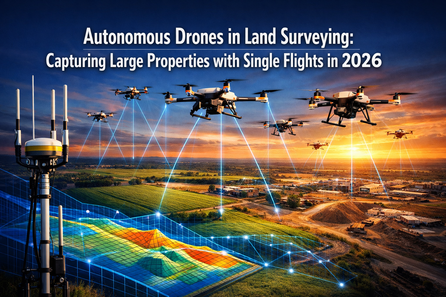
The land surveying industry stands at a transformative crossroads in 2026. Traditional methods that once required weeks of manual labor, multiple site visits, and extensive ground crews are rapidly giving way to a new era of precision and efficiency. Autonomous Drones in Land Surveying: Capturing Large Properties with Single Flights in 2026 represents more than just technological advancement—it signals a fundamental shift in how professionals approach large-scale property assessment, agricultural monitoring, and development projects. With self-flying UAVs now capable of independently generating optimal flight paths, adjusting to terrain variations in real-time, and delivering survey-grade accuracy without constant human intervention, the surveying landscape has been permanently altered.
This revolution arrives at a critical moment. The surveying industry faces significant labor shortages, with traditional workforce growth unable to meet escalating demand[5]. Simultaneously, project complexity continues to increase while clients demand faster turnaround times and more detailed data. Enter autonomous drone technology—equipped with predictive flight algorithms, multi-sensor arrays, and AI-driven processing capabilities that minimize site visits while maximizing data quality and detail.
Key Takeaways
🚁 Autonomous flight systems now enable drones to independently plan routes, avoid obstacles, and adjust to terrain without manual pilot control, transforming single-flight coverage of large properties from aspiration to reality.
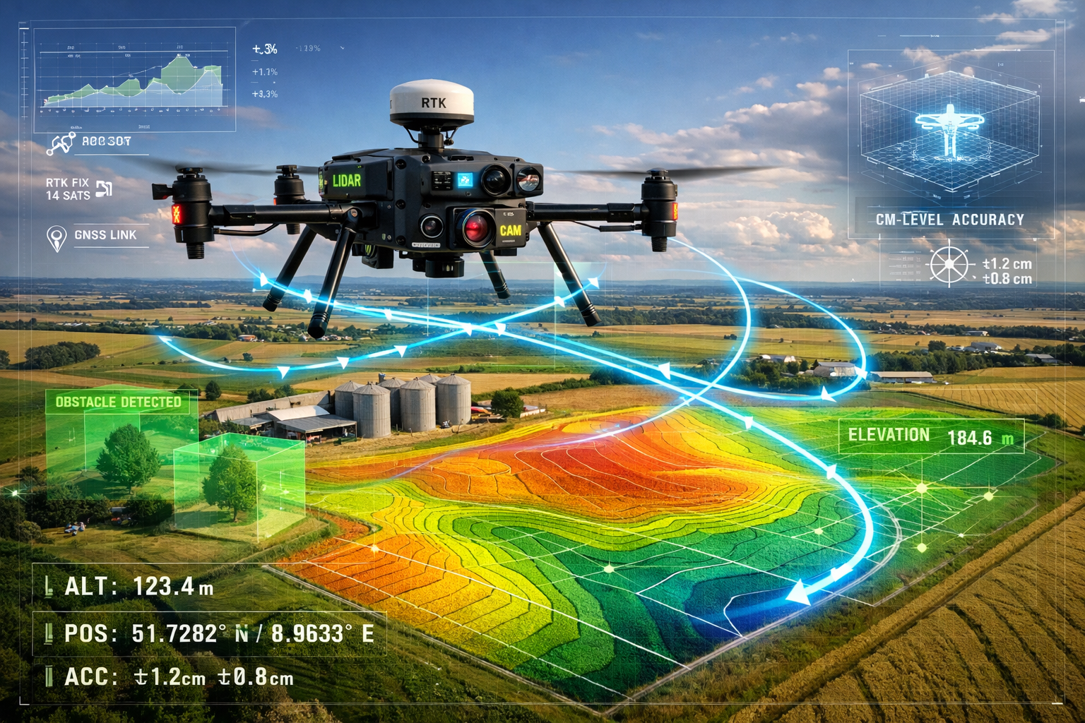
📊 Survey-grade accuracy of centimeter-level precision is achieved through RTK/PPK positioning systems, meeting professional standards that previously required extensive ground surveying[1][2].
🤖 AI-powered data processing and drone swarm technology dramatically reduce turnaround times while improving data consistency, enabling multiple coordinated UAVs to efficiently map vast areas with minimal human intervention[3][6].
⚡ Multi-sensor integration combines LiDAR, RGB cameras, thermal imaging, and multispectral sensors on single platforms, capturing comprehensive property data in one autonomous flight.
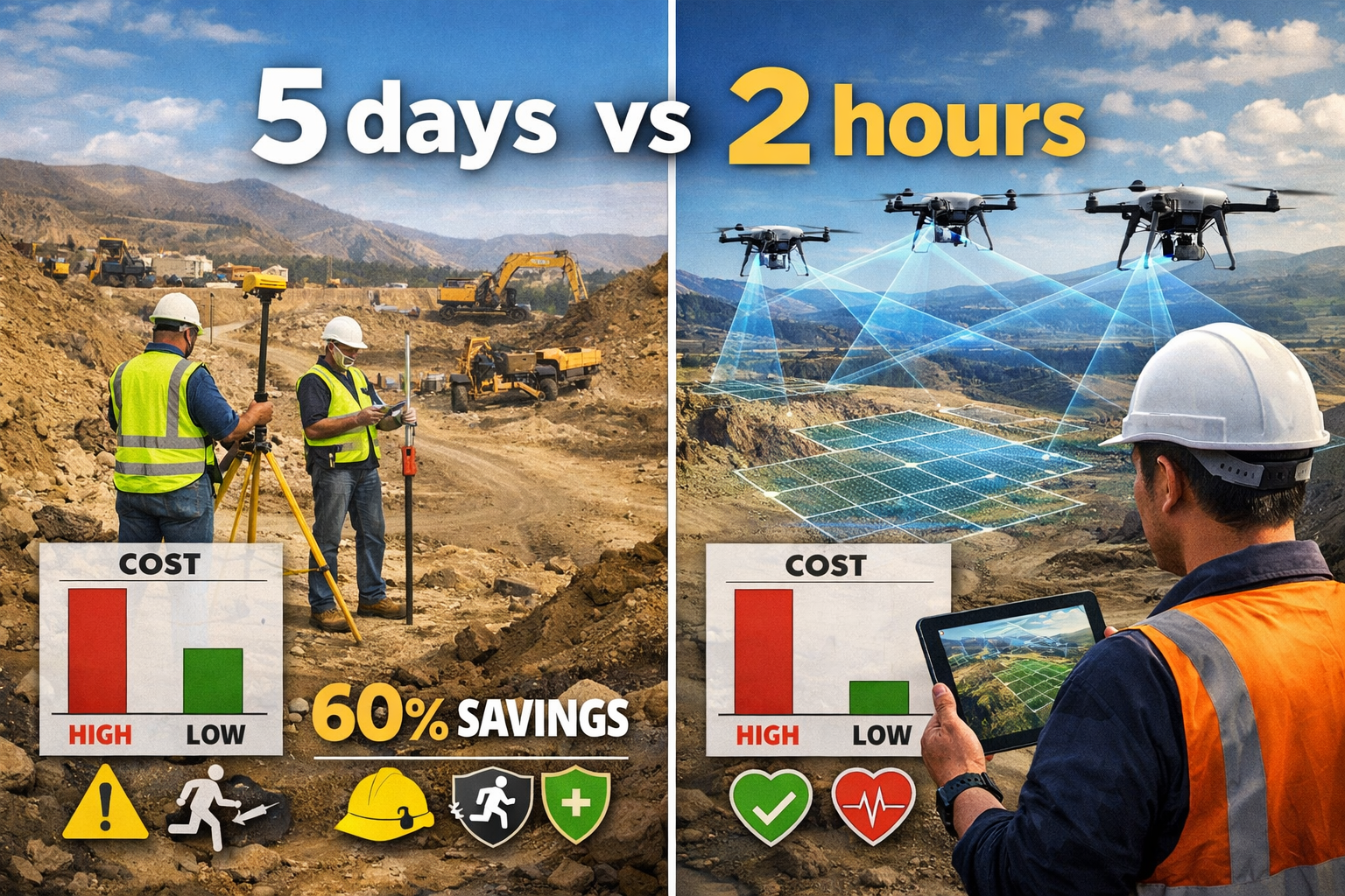
💰 Significant cost and time savings result from reduced labor requirements, fewer site visits, safer operations in hazardous areas, and faster project completion compared to traditional surveying methods[1][2].
The Evolution of Autonomous Flight in Land Surveying
From Manual Control to True Autonomy
The journey toward Autonomous Drones in Land Surveying: Capturing Large Properties with Single Flights in 2026 began with basic GPS-assisted flight but has evolved into sophisticated self-flying systems. Early drone surveying required skilled pilots to manually control every aspect of flight operations, limiting efficiency and introducing human error variables. Today's autonomous UAVs represent a quantum leap forward.
Modern self-flying drones independently generate optimal flight paths based on mission parameters, property boundaries, and desired data outputs[1]. Once surveyors input the survey area and requirements, the drone's onboard AI calculates the most efficient route, accounting for:
- Terrain variations and elevation changes
- Optimal altitude adjustments for consistent ground sample distance
- Battery life optimization for maximum coverage
- Weather conditions and wind compensation
- Regulatory airspace restrictions
This autonomous capability transforms large property surveying from a multi-day endeavor requiring constant pilot attention into streamlined operations where a single technician can deploy multiple drones sequentially or simultaneously.
Real-Time Obstacle Detection and Avoidance
One of the most critical advancements enabling single-flight large property coverage is real-time obstacle detection. Autonomous drones in 2026 utilize multiple sensor arrays including:
- Forward-facing collision avoidance sensors
- Downward-facing terrain mapping sensors
- 360-degree proximity detection systems
- Thermal imaging for low-visibility conditions
These systems work in concert to identify and navigate around unexpected obstacles—power lines, temporary structures, trees, wildlife, and other aircraft—without human intervention[1]. The drone automatically adjusts its flight path, maintains safe clearances, and continues the survey mission without interruption.
For surveyors working on large agricultural properties or development sites where conditions change rapidly, this capability ensures mission completion even when site conditions differ from initial planning assumptions. The result is reliable single-flight coverage regardless of property complexity.
Predictive Flight Path Technology
Perhaps the most transformative aspect of autonomous surveying in 2026 is predictive flight path technology. Unlike earlier systems that followed rigid pre-programmed routes, modern AI-driven drones continuously analyze terrain data during flight and adjust their paths predictively[1].
This technology enables:
Adaptive altitude control: The drone automatically increases altitude over tall structures or vegetation and decreases over flat terrain to maintain optimal imaging resolution.
Dynamic coverage optimization: If initial passes reveal areas requiring additional detail, the system automatically plans supplementary passes without returning to base.
Intelligent overlap management: The AI ensures proper image overlap for photogrammetry processing while avoiding redundant coverage that wastes battery life.
Terrain-following capabilities: For properties with significant elevation changes, the drone maintains consistent ground clearance rather than fixed altitude, ensuring uniform data quality across the entire survey area.
This predictive approach is particularly valuable for building surveys and large-scale property assessments where terrain complexity varies significantly across the site.
Multi-Sensor Integration: Capturing Comprehensive Data in Single Flights
The Power of Simultaneous Data Collection
The ability to capture diverse data types in a single autonomous flight represents a game-changing efficiency for land surveying in 2026. Modern autonomous drones integrate multiple sensor types on a single platform, eliminating the need for separate flights with different equipment configurations.
Primary sensor combinations include:
| Sensor Type | Data Captured | Primary Applications |
|---|---|---|
| High-Resolution RGB Cameras | Detailed visual imagery, orthomosaic maps | Property documentation, visual inspection, boundary identification |
| LiDAR Systems | Precise 3D point clouds, vegetation penetration | Digital terrain models, topographic surveys, volumetric calculations |
| Multispectral Sensors | Vegetation health indices (NDVI), crop analysis | Agricultural surveys, environmental monitoring, land use assessment |
| Thermal Imaging | Temperature variations, moisture detection | Irrigation analysis, drainage assessment, structural heat mapping |
| RTK/PPK GPS | Centimeter-level positioning accuracy | Survey-grade georeferencing, boundary surveys, control point verification |
This multi-sensor approach transforms data collection efficiency. Where traditional methods might require separate site visits for topographic surveying, visual documentation, and specialized assessments, autonomous drones capture all data simultaneously[1][2].
Survey-Grade Accuracy Through RTK and PPK Systems
Achieving survey-grade accuracy has historically been the primary barrier preventing drone adoption for professional land surveying. In 2026, this barrier has been definitively overcome through RTK (Real-Time Kinematic) and PPK (Post-Processed Kinematic) positioning systems.
RTK positioning provides real-time corrections to GPS data through a base station, delivering centimeter-level accuracy during flight operations[1][2]. The autonomous drone maintains constant communication with the base station, receiving correction signals that eliminate GPS errors caused by atmospheric interference, satellite geometry, and other factors.
PPK positioning offers similar accuracy through post-flight data processing, comparing drone GPS logs with base station data to achieve precise positioning without requiring real-time communication during flight. This approach proves particularly valuable for large properties where maintaining constant communication with a base station might be challenging.
The practical implications for large property surveying are profound:
✅ Boundary surveys meet legal requirements for property demarcation
✅ Volumetric calculations for stockpiles and earthwork achieve engineering-grade precision
✅ Topographic surveys rival traditional total station accuracy
✅ Control point verification validates survey accuracy across the entire property
For professionals conducting topographic surveys, this accuracy level eliminates the need for extensive ground control point networks, dramatically reducing fieldwork time.
AI-Driven Data Processing and Deliverables
The autonomous surveying workflow extends beyond flight operations into AI-driven data processing that accelerates project delivery. Modern systems automatically upload captured data to cloud-based processing platforms immediately upon landing, initiating analysis without manual intervention[1].
Automated processing generates:
📊 High-resolution orthomosaic maps: Geometrically corrected aerial imagery providing accurate measurements and visual documentation
🗻 Digital Surface Models (DSM): 3D representations including all surface features—buildings, vegetation, infrastructure
🏔️ Digital Elevation Models (DEM): Bare-earth terrain models with vegetation and structures removed
📐 3D point clouds: Dense spatial data sets enabling detailed measurements and modeling
📏 Volumetric calculations: Automated stockpile measurements, cut-and-fill analysis, capacity assessments
⚡ Change detection analysis: Comparison with previous surveys highlighting site modifications
This automated processing pipeline reduces turnaround time from data collection to deliverables from weeks to hours or days, depending on property size and complexity. For time-sensitive projects like construction monitoring or agricultural assessments, this speed advantage proves invaluable.
Autonomous Drones in Land Surveying for Large Properties: Industry Applications
Agricultural Land Management and Crop Monitoring
Autonomous Drones in Land Surveying: Capturing Large Properties with Single Flights in 2026 delivers exceptional value for agricultural applications. Large farming operations spanning hundreds or thousands of acres benefit from rapid, comprehensive surveying that would be impractical using traditional methods.
Key agricultural applications include:
🌾 Precision agriculture mapping: Multispectral sensors capture vegetation health indices (NDVI, NDRE) across entire properties, identifying areas requiring intervention for irrigation, fertilization, or pest management.
💧 Irrigation system assessment: Thermal imaging reveals moisture distribution patterns, highlighting inefficient irrigation zones and drainage issues.
📏 Field boundary documentation: Survey-grade accuracy enables precise field delineation for crop rotation planning, yield analysis by zone, and regulatory compliance.
🌱 Crop health monitoring: Regular autonomous flights throughout growing seasons track development, identify stress early, and quantify crop vigor variations.
The ability to survey large agricultural properties in single flights—without multiple site visits or extensive manual labor—enables farmers and agricultural consultants to make data-driven decisions quickly. Predictive flight paths automatically adjust to terrain variations across diverse agricultural landscapes, ensuring consistent data quality from irrigated valleys to hillside vineyards.
Construction and Development Site Surveying
Large construction and development projects represent another domain where autonomous single-flight surveying delivers transformative efficiency. Project sites often span extensive areas with rapidly changing conditions, making frequent, comprehensive surveys essential for project management.
Construction applications include:
🏗️ Site preparation surveys: Initial topographic mapping establishes baseline conditions, identifies drainage patterns, and supports grading design.
📊 Progress monitoring: Regular autonomous flights document construction advancement, verify work completion, and support progress billing.
📐 Volumetric analysis: Automated earthwork calculations track cut-and-fill quantities, stockpile volumes, and material movements.
🔍 Quality control verification: Comparison between as-built conditions and design specifications identifies deviations requiring correction.
⚠️ Safety monitoring: Aerial perspectives reveal potential hazards, access issues, and site organization problems.
For professionals managing commercial building surveys and large development projects, autonomous drones minimize site disruption while providing comprehensive documentation. The technology proves particularly valuable for projects where ground access is limited, hazardous, or would interfere with ongoing operations[1][2].
Mining and Quarry Operations
Mining and quarry operations exemplify the safety and efficiency advantages of Autonomous Drones in Land Surveying: Capturing Large Properties with Single Flights in 2026. These environments present significant hazards for traditional ground surveying crews while requiring frequent, accurate volumetric assessments.
Mining applications include:
⛏️ Stockpile volume measurement: Autonomous drones calculate aggregate, ore, and overburden volumes with accuracy rivaling traditional methods but without exposing personnel to unstable pile surfaces.
🗺️ Pit progression mapping: Regular surveys document excavation advancement, verify compliance with mining plans, and support resource estimation.
⚠️ Slope stability monitoring: Detailed terrain models identify potentially unstable areas, track movement over time, and support safety assessments.
📈 Rehabilitation monitoring: Post-mining site restoration tracking verifies compliance with environmental requirements and documents reclamation progress.
The autonomous nature of modern surveying drones proves especially valuable in active mining environments where conditions change daily and safety considerations limit ground access. Drones safely access dangerous zones including active faces, unstable slopes, and areas with heavy equipment operation[1][2].
Infrastructure and Transportation Corridors
Linear infrastructure projects—highways, railways, pipelines, transmission lines—present unique surveying challenges due to their extensive length and varied terrain. Autonomous drones excel at corridor surveying, capturing comprehensive data across miles of infrastructure in single or sequential flights.
Infrastructure applications include:
🛣️ Highway and railway surveys: Corridor mapping for design, construction monitoring, and maintenance planning across extensive alignments.
⚡ Utility corridor assessment: Transmission line inspections, pipeline route surveys, and right-of-way documentation.
🌉 Bridge and structure inspection: Detailed imagery and 3D models supporting structural assessments without requiring access equipment.
🔧 Maintenance prioritization: Regular surveys identify deterioration, drainage issues, and vegetation encroachment requiring intervention.
The predictive flight path capabilities of autonomous systems prove particularly valuable for infrastructure corridors, automatically adjusting altitude and coverage patterns to accommodate varying terrain while maintaining consistent data resolution. This capability enables comprehensive single-flight coverage of infrastructure segments that would require days or weeks using traditional surveying approaches.
For those interested in understanding different survey types and their applications, our guide on comparing different types of surveys provides valuable context.
Drone Swarm Technology: Multiplying Efficiency for Vast Properties
Coordinated Multi-Drone Operations
The frontier of Autonomous Drones in Land Surveying: Capturing Large Properties with Single Flights in 2026 extends beyond individual autonomous UAVs to drone swarm technology—multiple drones working in coordinated formation to survey vast properties with unprecedented speed and efficiency[3][6].
Drone swarms operate through sophisticated coordination algorithms that:
🔗 Divide survey areas: The swarm controller automatically partitions large properties into optimal zones based on drone battery capacity, terrain complexity, and coverage requirements.
📡 Synchronize flight operations: Multiple drones execute coordinated flight plans simultaneously, avoiding conflicts while maintaining communication.
🔄 Enable dynamic reallocation: If one drone encounters issues or requires battery replacement, the swarm automatically redistributes its coverage area among remaining units.
⚡ Accelerate data collection: Properties requiring hours for single-drone coverage can be surveyed in fractions of that time through parallel operations.
This technology proves transformative for extremely large properties—major agricultural operations, extensive development sites, large mining complexes—where even autonomous single-drone operations would require multiple flights and battery changes.
Minimal Human Intervention Requirements
The defining characteristic of modern drone swarm surveying is the minimal human intervention required throughout operations. A single technician can deploy, monitor, and recover an entire swarm, with the system handling:
✅ Automated mission planning across multiple units
✅ Collision avoidance between swarm members
✅ Battery management with automatic return-to-base protocols
✅ Data synchronization ensuring seamless integration of multi-drone datasets
✅ Quality control verification identifying coverage gaps requiring attention
This efficiency addresses the critical labor shortage facing the surveying industry[5]. Where traditional large-property surveys might require teams of surveyors working for days or weeks, autonomous swarm technology enables comprehensive coverage with a fraction of the personnel in a fraction of the time.
Precision Through Coordinated Flight Paths
The accuracy of swarm surveying depends on precise, coordinated flight paths that ensure consistent overlap between adjacent coverage areas—both within individual drone missions and between different swarm members[3][6].
Advanced swarm systems achieve this precision through:
📐 Unified mission planning: All swarm members operate from a single master plan ensuring proper coverage coordination.
🎯 Real-time position sharing: Drones continuously communicate their positions, enabling dynamic path adjustments maintaining optimal spacing.
🔍 Overlap verification: AI algorithms monitor image capture ensuring sufficient overlap for photogrammetry processing across swarm boundaries.
📊 Integrated data processing: Cloud platforms automatically merge multi-drone datasets into unified deliverables without manual intervention.
The result is survey data quality indistinguishable from single-drone operations but collected in a fraction of the time. For professionals conducting chartered surveying services across large properties, this technology enables service delivery previously impossible within practical timeframes and budgets.
Overcoming Challenges: Safety, Regulations, and Data Management
Navigating Regulatory Frameworks in 2026
The rapid advancement of Autonomous Drones in Land Surveying: Capturing Large Properties with Single Flights in 2026 has necessitated evolving regulatory frameworks balancing innovation with safety and privacy considerations. Surveyors deploying autonomous systems must navigate:
Airspace authorization requirements: Even autonomous operations require proper authorization for flights in controlled airspace, near airports, or above certain altitudes.
Visual line-of-sight regulations: While technology enables beyond-visual-line-of-sight (BVLOS) operations, many jurisdictions still require waivers or special approvals for such flights.
Privacy and data protection: Surveying large properties may inadvertently capture neighboring properties, requiring compliance with privacy regulations and data handling protocols.
Pilot certification: Although drones fly autonomously, operators typically still require appropriate licensing demonstrating knowledge of aviation regulations, safety procedures, and emergency protocols.
Insurance requirements: Professional surveying operations must maintain appropriate liability coverage for autonomous drone operations.
Successful deployment of autonomous surveying technology requires staying current with regulatory developments and maintaining compliance across all operational jurisdictions. Professional organizations and industry associations provide valuable resources for navigating this evolving landscape.
Ensuring Data Security and Quality
The automated data collection and cloud-based processing enabling rapid turnaround also introduces data security and quality considerations requiring careful management:
🔒 Secure data transmission: Automated upload of survey data to cloud platforms requires encrypted communication channels protecting client confidentiality.
💾 Redundant data storage: Critical survey data demands backup systems preventing loss from equipment failure or transmission interruptions.
✅ Quality assurance protocols: Automated processing must include verification steps ensuring deliverables meet accuracy specifications and professional standards.
🔍 Metadata management: Comprehensive documentation of collection parameters, processing methods, and accuracy assessments supports professional liability protection.
📋 Client data ownership: Clear protocols defining data ownership, usage rights, and retention periods protect both surveyors and clients.
For those conducting detailed property assessments, understanding quality standards is essential—our guide on what surveyors look for in house surveys provides relevant context applicable to drone surveying quality considerations.
Hazardous Area Access and Worker Safety
One of the most compelling advantages of Autonomous Drones in Land Surveying: Capturing Large Properties with Single Flights in 2026 is the ability to safely access hazardous surveying zones that would endanger ground crews[1][2].
Hazardous environments safely surveyed include:
⚠️ Active construction sites: Drones capture comprehensive data without exposing surveyors to heavy equipment, excavations, or unstable structures.
⛏️ Mining operations: Autonomous flights access active pits, unstable slopes, and areas with blast hazards.
🚧 Highway corridors: Infrastructure surveys proceed without requiring lane closures or exposing personnel to traffic.
🌊 Flood-prone areas: Terrain mapping continues in areas with standing water, unstable ground, or access restrictions.
🌲 Dense vegetation: Autonomous navigation enables surveying heavily wooded properties where ground access is impractical.
This safety advantage addresses both humanitarian and economic considerations. Reducing surveyor exposure to hazardous conditions protects personnel while avoiding project delays, workers' compensation claims, and liability issues associated with on-site accidents.
The technology proves particularly valuable for specific defect surveys where accessing certain areas for detailed inspection might otherwise require expensive access equipment or expose inspectors to risk.
Future Developments: The Next Frontier of Autonomous Surveying
Edge Computing and Real-Time 3D Mapping
The evolution of Autonomous Drones in Land Surveying: Capturing Large Properties with Single Flights in 2026 continues with emerging technologies that will further transform the industry. Edge computing integration represents one of the most promising developments[1].
Edge computing enables onboard processing of captured data during flight operations, rather than waiting for post-flight cloud processing. This capability enables:
⚡ Real-time 3D terrain model generation during flight operations
🔍 Immediate identification of coverage gaps triggering automatic supplementary passes
📊 Instant quality verification ensuring data meets specifications before leaving the site
🎯 Dynamic mission adjustment based on preliminary data analysis during flight
This real-time processing capability will eliminate the current gap between data collection and deliverable generation, enabling surveyors to verify survey completeness and quality before demobilizing from the site.
Autonomous Charging Infrastructure
Battery life currently represents the primary limitation on single-flight coverage area for autonomous drones. Autonomous charging stations in development will overcome this constraint[1].
These systems enable:
🔋 Automatic battery swapping: Drones autonomously land at charging stations, swap depleted batteries for charged units, and resume surveying without human intervention.
⚡ Wireless charging pads: Inductive charging systems replenish battery capacity during brief landing intervals.
🔄 Extended mission duration: Large properties requiring multiple battery cycles can be surveyed in a single autonomous operation spanning hours.
📍 Distributed charging networks: Multiple charging stations positioned across vast properties enable continuous operations across extensive areas.
This infrastructure will enable truly autonomous large-property surveying where drones independently manage their energy requirements throughout extended missions.
AI-Based Predictive Terrain Analysis
Future autonomous surveying systems will incorporate AI-based predictive terrain analysis that anticipates site conditions before arrival, optimizing mission planning and execution[1].
This technology will:
🗺️ Analyze satellite imagery and existing terrain data to predict optimal flight parameters before deployment
🌤️ Integrate weather forecasting for mission timing optimization
📊 Estimate required flight time and battery requirements with high accuracy
🎯 Pre-identify areas requiring special attention or supplementary coverage
⚡ Optimize swarm coordination based on predicted terrain complexity across different property zones
These predictive capabilities will further reduce site visits and human intervention requirements, enabling surveyors to deploy autonomous systems with confidence in mission success even for unfamiliar properties.
Integration with Digital Twin Technology
The convergence of autonomous surveying with digital twin technology will create persistent, continuously updated virtual representations of large properties. Regular autonomous surveys will automatically update digital twins, enabling:
📈 Continuous change detection identifying modifications without manual comparison
🔮 Predictive maintenance for infrastructure based on condition trending
📊 Historical analysis tracking property evolution over time
🎯 Automated compliance verification comparing current conditions against regulatory requirements
For development projects and agricultural operations, digital twins maintained through regular autonomous surveys will provide unprecedented visibility into property conditions and changes.
Cost-Benefit Analysis: ROI of Autonomous Surveying Systems
Initial Investment Considerations
Implementing Autonomous Drones in Land Surveying: Capturing Large Properties with Single Flights in 2026 requires upfront investment that varies based on system capabilities and intended applications.
Investment components include:
| Component | Cost Range | Considerations |
|---|---|---|
| Autonomous Drone Platform | $15,000 – $100,000+ | Survey-grade systems with RTK/PPK, multi-sensor capability |
| Processing Software | $2,000 – $10,000/year | Photogrammetry, point cloud processing, specialized analysis |
| Ground Control Equipment | $5,000 – $25,000 | RTK base stations, survey-grade GPS receivers |
| Training and Certification | $1,000 – $5,000 | Pilot licensing, equipment operation, data processing |
| Insurance | $2,000 – $10,000/year | Professional liability, equipment coverage |
| Maintenance and Upgrades | 10-15% annually | Battery replacement, sensor calibration, software updates |
While these costs represent significant investment, they must be evaluated against the operational savings and revenue opportunities autonomous surveying enables.
Operational Cost Savings
The ongoing operational advantages of autonomous surveying deliver substantial cost savings compared to traditional methods[1][2]:
💰 Reduced labor requirements: Single technician operations replace multi-person survey crews
⏱️ Faster project completion: Hours instead of days or weeks for large property surveys
🚗 Fewer site visits: Comprehensive single-flight coverage eliminates multiple mobilizations
⚠️ Lower safety costs: Reduced hazard exposure decreases insurance premiums and incident costs
🔍 Improved accuracy: Fewer errors and rework requirements reduce project costs
For surveying firms conducting regular large-property assessments, these operational savings typically enable investment recovery within 1-3 years depending on project volume and size.
Competitive Advantages and Revenue Opportunities
Beyond cost savings, autonomous surveying technology creates competitive advantages and new revenue opportunities:
🚀 Faster proposal response: Rapid deployment enables quick turnaround on time-sensitive opportunities
📊 Enhanced service offerings: Multi-sensor capabilities support diverse service lines from single platforms
🎯 Larger project capacity: Efficiency gains enable serving more clients without proportional staff increases
⭐ Quality differentiation: Survey-grade accuracy and comprehensive deliverables distinguish services
🌐 Geographic expansion: Reduced mobilization costs make distant projects economically viable
These advantages enable surveyors to compete more effectively, command premium pricing for superior service, and expand their market reach.
For professionals considering whether to invest in advanced surveying capabilities, understanding the value proposition is essential—similar to how property buyers evaluate whether homebuyer surveys are worth the investment.
Selecting the Right Autonomous Surveying System
Matching Technology to Application Requirements
Selecting appropriate autonomous surveying technology requires careful evaluation of application requirements against system capabilities:
Key selection criteria include:
📏 Accuracy requirements: Survey-grade work demands RTK/PPK systems; reconnaissance work may accept lower precision
📐 Property size: Battery life and flight speed determine single-flight coverage capability
🎯 Data types needed: Required sensors (RGB, LiDAR, multispectral, thermal) influence platform selection
🌤️ Environmental conditions: Wind resistance, temperature tolerance, precipitation capability
⚡ Processing requirements: Onboard vs. cloud processing, real-time vs. post-flight deliverables
🔄 Integration needs: Compatibility with existing software, workflows, and data systems
Surveyors should prioritize systems matching their primary applications while offering reasonable flexibility for secondary uses. Over-specifying capabilities increases costs without proportional value; under-specifying limits service capabilities and competitiveness.
Vendor Evaluation and Support Considerations
Beyond technical specifications, vendor selection significantly impacts long-term success with autonomous surveying:
✅ Technical support availability: Responsive assistance for operational issues, calibration, troubleshooting
📚 Training programs: Comprehensive operator training, ongoing education on new capabilities
🔧 Maintenance services: Repair capabilities, replacement parts availability, calibration services
⬆️ Upgrade paths: Software updates, hardware enhancement options, technology roadmap
🤝 User community: Active user groups providing peer support and best practice sharing
Established vendors with proven track records in professional surveying typically provide superior long-term value compared to lower-cost alternatives with limited support infrastructure.
Integration with Existing Workflows
Successful implementation of Autonomous Drones in Land Surveying: Capturing Large Properties with Single Flights in 2026 requires thoughtful workflow integration:
🔄 Data format compatibility: Ensuring drone outputs integrate seamlessly with existing CAD, GIS, and analysis software
📊 Quality control procedures: Incorporating autonomous survey data into established QA/QC protocols
📋 Client deliverable standards: Maintaining consistency in report formats and presentation
👥 Staff training: Developing team competency in autonomous system operation and data processing
📈 Project management: Adapting scheduling, pricing, and resource allocation for autonomous capabilities
Organizations that invest adequate time in workflow integration realize technology benefits more quickly and completely than those treating autonomous systems as standalone tools separate from core operations.
Best Practices for Autonomous Large-Property Surveying

Pre-Flight Planning and Site Assessment
Successful autonomous large-property surveying begins with thorough pre-flight planning:
🗺️ Property boundary verification: Confirming survey area extent, identifying access points, noting restrictions
📡 Airspace evaluation: Checking for controlled airspace, temporary flight restrictions, authorization requirements
🌤️ Weather assessment: Evaluating wind conditions, precipitation forecasts, lighting for optimal data collection
⚡ Obstacle identification: Noting power lines, towers, structures requiring flight path consideration
📊 Mission parameter definition: Establishing flight altitude, overlap requirements, ground sample distance targets
While autonomous systems handle flight execution, careful planning ensures mission success and regulatory compliance. Many systems enable remote planning using satellite imagery and terrain data, minimizing on-site preparation time.
Ground Control Point Strategy
Even with RTK/PPK positioning providing centimeter-level accuracy, strategic ground control point (GCP) placement enhances survey reliability:
🎯 Reduced GCP requirements: Survey-grade positioning dramatically reduces GCP density compared to non-RTK systems
📍 Strategic placement: Positioning GCPs at property corners and elevation extremes maximizes verification value
✅ Verification points: Including check points not used in processing enables independent accuracy assessment
📐 Proper marking: Using targets visible in aerial imagery and precisely surveyed with total station or survey-grade GPS
For large properties, autonomous RTK/PPK surveying may require only a handful of GCPs compared to dozens needed for traditional photogrammetry, significantly reducing fieldwork time.
Data Processing and Quality Verification
Post-flight data processing and quality verification ensure deliverables meet professional standards:
🔍 Image quality review: Checking for motion blur, proper exposure, adequate overlap before processing
📊 Processing parameter optimization: Adjusting settings for optimal accuracy and detail in deliverables
✅ Accuracy assessment: Comparing results against ground control and check points, verifying specifications
🎯 Deliverable generation: Creating required outputs—orthomosaics, terrain models, point clouds, reports
📋 Documentation: Recording collection parameters, processing methods, accuracy results for professional records
Automated processing platforms accelerate this workflow, but professional review remains essential for quality assurance. Surveyors should establish clear quality thresholds and verification protocols ensuring consistent deliverable standards.
For those interested in comprehensive property assessment methodologies, our guide on Level 3 building surveys provides relevant context on thorough evaluation approaches.
Conclusion: Embracing the Autonomous Surveying Revolution
Autonomous Drones in Land Surveying: Capturing Large Properties with Single Flights in 2026 represents far more than incremental technological improvement—it fundamentally transforms how surveying professionals approach large-scale property assessment. The convergence of autonomous flight capabilities, multi-sensor integration, survey-grade positioning accuracy, and AI-driven data processing has created unprecedented opportunities for efficiency, safety, and service quality.
The technology addresses critical industry challenges including labor shortages, increasing project complexity, client demands for faster turnaround, and safety concerns in hazardous environments. By enabling comprehensive large-property coverage in single autonomous flights with minimal human intervention, modern surveying systems deliver value previously unattainable through traditional methods.
The Path Forward
For surveying professionals, the question is no longer whether to adopt autonomous technology but how to implement it most effectively. The competitive landscape increasingly favors firms offering the speed, accuracy, and comprehensive data that autonomous systems provide. Organizations that embrace this technology thoughtfully—matching systems to applications, integrating workflows effectively, and developing team competencies—position themselves for sustained success in an evolving industry.
The future trajectory is clear: autonomous capabilities will continue advancing through edge computing, extended flight duration, swarm coordination maturation, and AI-enhanced analysis. Early adopters gain not only immediate operational advantages but also experience and expertise positioning them to leverage future developments as they emerge.
Actionable Next Steps
For those ready to explore Autonomous Drones in Land Surveying: Capturing Large Properties with Single Flights in 2026, consider these concrete steps:
-
Assess your application portfolio: Identify which projects would benefit most from autonomous surveying—large agricultural properties, extensive development sites, infrastructure corridors, mining operations.
-
Evaluate technology options: Research autonomous drone platforms matching your primary applications, considering accuracy requirements, sensor needs, and coverage capabilities.
-
Develop implementation plan: Create a phased approach including equipment acquisition, staff training, workflow integration, and pilot project selection.
-
Invest in training: Ensure team members develop competency in autonomous system operation, data processing, and quality verification.
-
Start with pilot projects: Test autonomous capabilities on representative projects, refine workflows, and document results before full-scale deployment.
-
Stay informed: Monitor technology developments, regulatory changes, and industry best practices through professional organizations and vendor resources.
The autonomous surveying revolution is here. The firms that embrace it strategically will define the industry's future, delivering superior service while building sustainable competitive advantages. The technology, regulatory framework, and market demand have aligned—the time to act is now.
For additional guidance on surveying services and methodologies, explore our comprehensive resources on what survey you need for various property types and project requirements.
References
[1] Self Flying Uavs For Survey Mapping Are Redefining Aerial Intelligence – https://www.dronitech.com/self-flying-uavs-for-survey-mapping-are-redefining-aerial-intelligence/
[2] Ai Drones For Surveying Enhancing Land Mapping Precision And Efficiency – https://www.arcsurveyors.com/ai-drones-for-surveying-enhancing-land-mapping-precision-and-efficiency/
[3] How Technology Is Revolutionizing Land Surveys – https://www.firstchoicesurveying.com/blog/how-technology-is-revolutionizing-land-surveys
[4] Drone Surveying – https://uavcoach.com/drone-surveying/
[5] Watch – https://www.youtube.com/watch?v=CSTodaZb4Vc
[6] Revolutionizing Land Surveying The Rise Of Drone Technology And Uav Applications In 2026 – https://nottinghillsurveyors.com/blog/revolutionizing-land-surveying-the-rise-of-drone-technology-and-uav-applications-in-2026
[7] Drones In Construction – https://acecoretechnologies.com/drones-in-construction/