
Boundary disputes cost UK property owners an estimated tens of thousands of pounds in legal fees before a single court hearing begins, yet the root cause is often a gap of centimetres that a tape measure simply cannot resolve. Geographic Positioning Systems in Property Surveying: How UK Surveyors Use GPS for Boundary, Party Wall and Valuation Evidence has moved from specialist niche to professional standard, reshaping how chartered surveyors gather, document and defend spatial data in 2026. From RTK receivers tied to the Ordnance Survey National Grid to drone orthomosaics admissible in court, the technology now underpins every stage of the surveying process.
Key Takeaways
- Modern UK surveyors use GNSS/GPS receivers and total stations to achieve centimetre-level positional accuracy, tied directly to the Ordnance Survey National Grid for Land Registry comparability.
- RTK drone surveys can produce orthomosaics accurate to approximately 2 cm, providing defensible boundary and party wall evidence when supported by rigorous ground control point documentation.
- RICS' "Boundaries" professional standard (4th edition, 2022) remains the governing framework for how GPS evidence must be collected, documented and presented in disputes.
- Expert-witness reports now require full technical documentation of equipment calibration, ground control points and chain-of-custody protocols for all GNSS data.
- Ordnance Survey's ongoing infrastructure upgrades, including new Trimble R980 GNSS receivers and the forthcoming Basemap Pro product, are strengthening the national reference framework that underpins all GPS-based property evidence.
Why GPS Has Become the Backbone of UK Property Surveying
For most of the twentieth century, UK boundary surveys relied on steel tapes, optical theodolites and scaled drawings. The margin for error was measured in tens of centimetres, tolerable for rural farmland, but dangerously imprecise for urban terraced properties where a disputed strip of land can be worth hundreds of thousands of pounds.
Geographic Positioning Systems in Property Surveying: How UK Surveyors Use GPS for Boundary, Party Wall and Valuation Evidence changed the calculus entirely. Today, GNSS (Global Navigation Satellite System) receivers, the broader family that includes GPS, GLONASS, Galileo and BeiDou, allow a surveyor to establish a point's position to within 10-20 mm in real time, and to sub-centimetre accuracy with post-processing. This is not a marginal improvement; it is a qualitative shift in what counts as reliable spatial evidence.
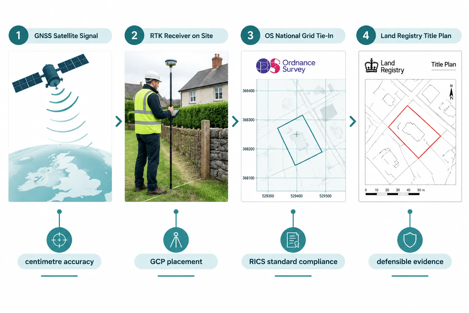
Chartered surveying firms such as JC White Geomatics now use state-of-the-art Leica GNSS equipment and total stations to map boundary areas "far more adequately and accurately than a tape measure," with all surveys linked to the OS National Grid so they are directly comparable to Land Registry title plans [7]. Camb Surveyors similarly describe producing highly accurate digital surveys based on GNSS observations, using the data to advise on likely boundary locations and prepare measured plans for Land Registry submissions [15].
The shift has been reinforced from the top down. Ordnance Survey, the national mapping authority, awarded a nationwide GNSS upgrade contract to KOREC in May 2025, selecting Trimble R980 receivers to modernise its field survey equipment and bolster the accuracy of the national reference framework [4]. The OS annual report for 2025-2026 confirms ongoing enhancement of geospatial data services supporting land, property and planning users across Great Britain [5].
The practical result: a surveyor arriving on site in 2026 carries equipment that connects directly to a satellite constellation, references a nationally maintained coordinate framework, and produces data that can be overlaid onto Land Registry title plans without manual conversion. The days of "scaling off" a paper plan are over.
GPS Evidence in Boundary Disputes and Party Wall Matters
How Surveyors Use GPS to Establish Boundary Lines
When a boundary dispute arises, the first evidential question is: where, precisely, does the legal boundary run? Title plans registered at Land Registry are drawn to a scale of 1:1250 in urban areas, meaning a line 1 mm wide on the plan represents 1.25 m on the ground. GPS-based measured surveys close that gap dramatically.
A June 2026 analysis of boundary dispute resolution strategies for chartered surveyors confirms that GPS total station surveys and expert-witness reports now provide courts and mediators with precise, defensible boundary evidence [2]. The same guidance highlights drone-assisted topographic surveys combined with GPS, enabling sub-centimetre plotting of walls, fences and hedges relative to Ordnance Survey data and Land Registry title plans [2].
The recommended workflow typically follows these steps:
- Establish ground control points (GCPs) at known OS National Grid coordinates using a GNSS receiver or total station.
- Occupy boundary features, walls, fence posts, hedge centres, with the GNSS pole or prism, recording coordinates for each.
- Process and adjust the raw observations against the OS reference framework.
- Overlay the results onto the Land Registry title plan at the correct scale.
- Produce a measured boundary plan that can be submitted as evidence in dispute resolution or court proceedings.
For disputes that escalate beyond informal negotiation, parties are advised to commission a GPS boundary survey from a RICS-accredited surveyor at the earliest sign of conflict [2]. Early commissioning preserves the physical state of boundary features before they are altered and establishes a contemporaneous evidential record.
For detailed guidance on how party wall procedures interact with boundary evidence, see RICS party wall surveyors expert guidance for property disputes and the comprehensive overview of party wall surveyors: roles, responsibilities and legal requirements.
GPS in Party Wall Surveys: Condition Records and Spatial Evidence
The Party Wall etc. Act 1996 requires surveyors to record the condition of adjoining structures before notifiable works begin. Traditionally, this meant photographs and written schedules. GPS now adds a spatial dimension: coordinates can be assigned to crack locations, wall faces and structural features, creating a georeferenced condition record that can be compared with post-works measurements.
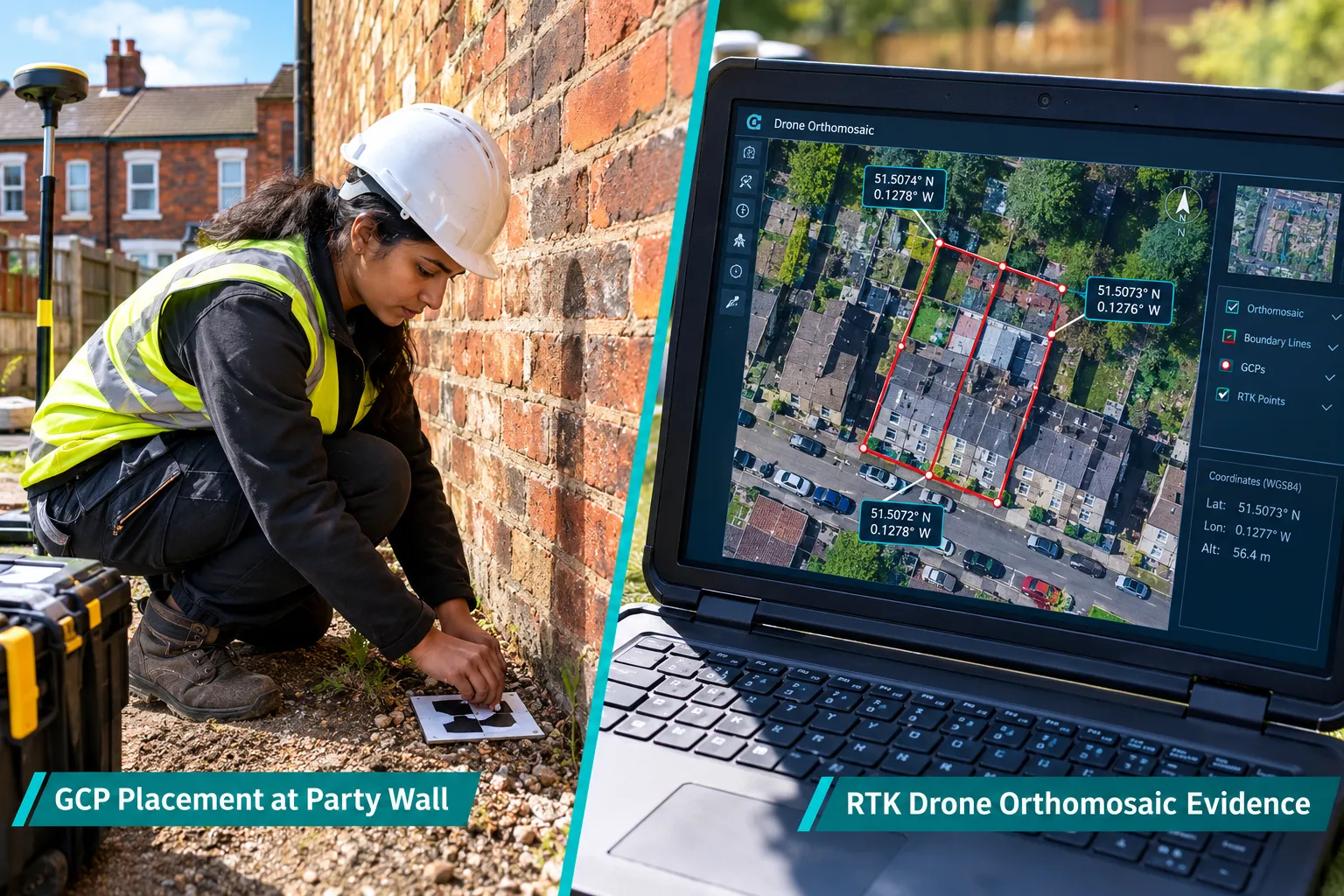
This matters most when damage is alleged after construction. A georeferenced pre-works record allows a surveyor to demonstrate, with measurable precision, whether a crack has widened, a wall has deflected or a boundary structure has moved. Without GPS coordinates, the comparison relies on photographic interpretation alone, a weaker evidential basis.
For property owners navigating these procedures, the guide to resolving party wall disputes explains the legal framework in accessible terms. Those considering whether an agreement is needed can consult the resource on when you need a party wall agreement.
The RICS Standard: The Governing Framework for GPS Evidence
No discussion of GPS in UK property surveying is complete without reference to RICS' "Boundaries: procedures for boundary identification, demarcation and dispute resolution" (4th edition, October 2022). This professional standard is explicitly cited in 2026 guidance as the primary reference for boundary surveyors and expert-witness reports [9]. It sets out procedural expectations around measured surveys, documentary evidence and dispute resolution, and it defines the minimum requirements that GPS-derived evidence must meet to be accepted by courts and professional panels [9].
Key principle from the RICS standard: GPS/GNSS methodologies must be framed within the RICS boundary procedures framework to be accepted as credible evidence in UK legal and professional proceedings.
Surveyors who collect GPS data without following the RICS framework risk having their evidence challenged on procedural grounds, regardless of its technical accuracy. The standard is not optional; it is the professional baseline.
RTK Drones, Ground Control Points and Expert-Witness Admissibility
Drone Surveys as GPS-Enabled Boundary Evidence
Real-Time Kinematic (RTK) drone surveys represent the most significant recent development in GPS-based property evidence. An RTK-equipped drone carries a GNSS receiver that corrects its position in real time against a base station or network correction service, enabling it to produce orthomosaic images, geometrically corrected aerial photographs, accurate to approximately 2 cm [12].
A July 2026 guidance document for surveyors conducting drone-based boundary evidence work confirms that RTK GPS drone orthomosaics can achieve ±2 cm accuracy and are considered reliable boundary evidence when properly documented [12]. The same guidance specifies that RTK or PPK (Post-Processed Kinematic) GPS capability is a minimum requirement for RICS-compliant boundary surveying drones [12].
The broader operational context supports this: a BBC report from August 2026 on wildfire risk mapping describes a UK drone team achieving up to 2 cm mapping accuracy in applied land-management work [3], confirming that this level of precision is now routine outside the surveying profession as well.
Ground Control Points: The Chain of Custody for GPS Data
The admissibility of GPS-derived boundary evidence depends not only on the accuracy of the measurements but on the rigour with which they were obtained and documented. 2026 guidance for surveyors advises a minimum of five GCPs distributed across the survey area, with coordinates established using total stations or GNSS receivers of known accuracy [12].
Each GCP must be:
- Photographed before and after drone flights to confirm it was not disturbed.
- Assigned coordinates from a GNSS receiver or total station tied to the OS National Grid.
- Documented with positional error statistics in the final report.
Expert-witness reports must also record equipment calibration, flight logs and an unbroken chain of custody for all drone and GNSS data [12]. This level of documentation reflects how technical GNSS details are now expected in boundary and party wall expert reports submitted to courts and RICS dispute resolution panels [12].
The recommended report structure for GPS-based boundary evidence includes:
| Report Section | Required Content |
|---|---|
| Equipment specification | GNSS receiver model, firmware version, calibration date |
| GCP coordinates | OS National Grid eastings/northings, accuracy statistics |
| Flight log | Date, time, weather, pilot certification |
| Orthomosaic metadata | Ground sample distance, overlap percentage, accuracy report |
| Chain of custody | Data storage, transfer and encryption records |
| Boundary analysis | Overlay on Land Registry title plan, measured distances |
For those seeking specialist support, expert witness surveyors in London provide RICS-chartered expertise in preparing GPS-based evidence for legal proceedings.
GPS and Valuation Evidence: Precision Mapping in Property Appraisal
How Geographic Positioning Systems Support Valuation Work
The connection between Geographic Positioning Systems in Property Surveying: How UK Surveyors Use GPS for Boundary, Party Wall and Valuation Evidence and formal property valuation is less obvious than the boundary dispute application, but it is equally significant. Accurate site measurement is a prerequisite for reliable valuation: floor areas, plot sizes, access widths and site configurations all feed directly into comparable analysis and development appraisal.
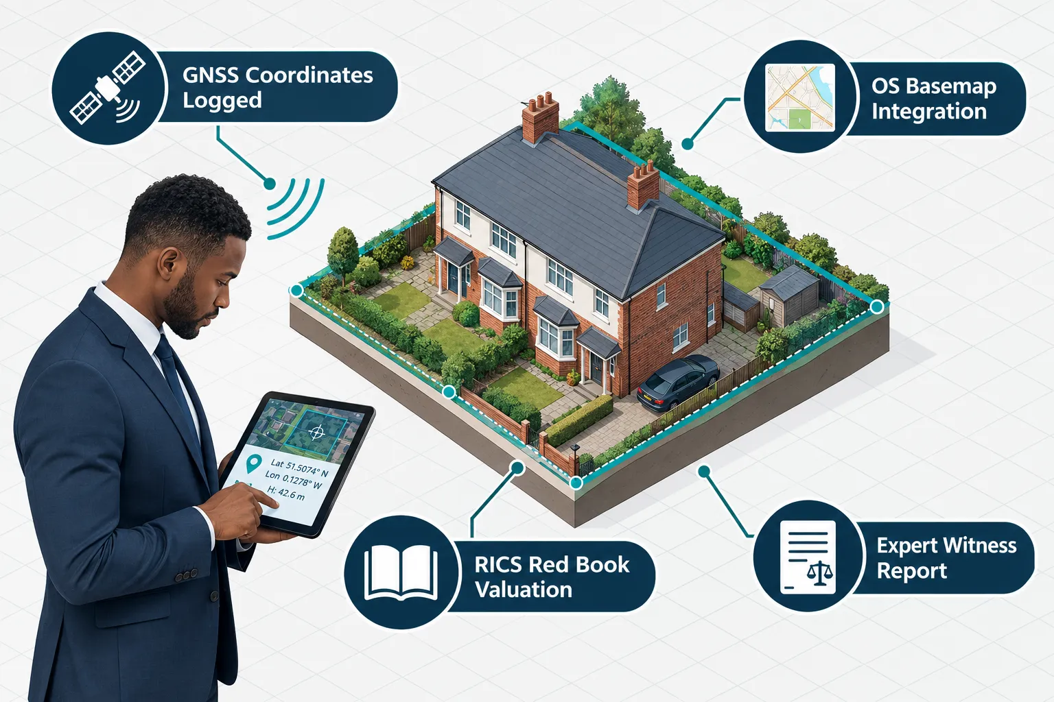
GPS-based surveys provide the base data from which measured site plans are drawn, ensuring that the areas and dimensions used in a RICS Red Book valuation are verifiable and reproducible. For complex sites, irregular plots, sloping land, properties with disputed boundaries, GPS-derived measurements offer a level of precision that manual methods cannot match.
Ordnance Survey's building data enhancements, announced in September 2023, improved attributes and geometry for millions of buildings within the OS National Geographic Database [11], strengthening the data used for property valuation and risk assessments. The forthcoming Basemap Pro product, with an alpha release targeted for autumn 2026 and a full launch expected in 2027, promises a next-generation trusted basemap for Great Britain that will be tightly integrated with GNSS positioning [14].
These infrastructure improvements matter for valuers because they provide a richer, more accurate base layer against which GPS-collected site data can be referenced. A valuation that references OS Basemap Pro coordinates will carry greater evidential weight than one based on scaled measurements from an older map.
Specialist Valuation Contexts Where GPS Evidence Is Critical
Several specialist valuation contexts place particular demands on spatial accuracy:
Matrimonial and litigation valuations, where the precise extent of a property interest may be disputed, GPS-measured site plans provide an objective basis for the valuation. See matrimonial valuation services for context on how these valuations are structured.
Capital gains tax and non-domicile valuations, HMRC submissions require defensible evidence of property extent and condition at a specific date. GPS-based measured surveys create a contemporaneous spatial record. Further detail is available on capital gains tax valuation and non-domicile tax valuation.
Lease extension valuations, the extent of the demised premises, including any garden or external areas, affects the premium calculation. GPS measurement of the demise removes ambiguity. See lease extension valuation for the full process.
Boundary surveys for Land Registry, boundary surveys that are tied to the OS National Grid can be submitted to Land Registry to update title plans, providing a permanent record of the agreed boundary position.
The Future of GPS in UK Property Surveying
AI Integration and Richer OS Basemaps
The trajectory of GPS use in UK property surveying points toward greater automation and tighter integration with authoritative data sources. A July 2026 guidance document references a global AI standard from RICS that became effective in March 2026, recommending that surveyors review AI disclosure obligations and update report templates accordingly [12]. This signals forthcoming integration of AI-assisted processing of GNSS and imagery data in boundary evidence workflows.
OS's Basemap Pro roadmap, alpha in autumn 2026, full launch expected in 2027, indicates that surveyors will soon have access to a more sophisticated, standardised basemap likely to be tightly integrated with GNSS positioning [14]. Recent hardware developments, including RTK-enabled receivers with built-in correction services that deliver centimetre-accurate surveying effectively "out of the box," reflect the mainstreaming of high-precision GNSS across the profession [8].
Taken together, these developments point to increasingly automated, standards-driven workflows where GPS/GNSS, AI processing and authoritative OS data jointly underpin boundary, party wall and valuation evidence. Surveyors who invest now in RTK-capable equipment, rigorous GCP documentation and RICS-compliant reporting structures will be well positioned as these workflows mature.
Conclusion
Geographic Positioning Systems in Property Surveying: How UK Surveyors Use GPS for Boundary, Party Wall and Valuation Evidence has reached a point of professional maturity in 2026 where GPS is not a premium add-on but a baseline expectation. Centimetre-accurate GNSS observations, RTK drone orthomosaics and rigorously documented ground control points now form the evidential backbone of boundary disputes, party wall proceedings and specialist valuations across the UK.
Actionable next steps for property owners and professionals:
- Commission a GPS boundary survey early. At the first sign of a boundary or party wall dispute, engage a RICS-accredited surveyor to establish a georeferenced record of the current physical position of all boundary features.
- Insist on RICS-standard documentation. Any GPS or drone survey intended for use as evidence should include full equipment records, GCP coordinates, positional error statistics and a chain-of-custody log.
- Reference the OS National Grid. Ensure all measured surveys are tied to OS National Grid coordinates so they are directly comparable to Land Registry title plans.
- Engage specialist expert witnesses for litigation. Where GPS evidence will be used in court or RICS dispute resolution, the report must comply with the RICS Boundaries professional standard (4th edition) and any applicable Civil Procedure Rules for expert witnesses.
- Stay ahead of OS infrastructure changes. Monitor Ordnance Survey's Basemap Pro rollout and update survey workflows to take advantage of richer base data as it becomes available.
The precision that GPS brings to property surveying is not merely technical, it is legal, financial and reputational. A well-documented GPS survey can resolve in hours a dispute that would otherwise take years and cost tens of thousands of pounds to litigate.
References
[2] Boundary Dispute Resolutions 2026 Chartered Surveyor Strategies Beyond Party Wall Act Using RICS Mediation Protocols – https://princesurveyors.co.uk/blog/boundary-dispute-resolutions-2026-chartered-surveyor-strategies-beyond-party-wall-act-using-rics-mediation-protocols/
[3] BBC News Article on Drone Mapping Accuracy – https://www.bbc.com/news/articles/cp3rvd3ygqvo
[4] Award Of GNSS Upgrade To KOREC – https://www.ordnancesurvey.co.uk/news/award-of-gnss-upgrade-to-korec
[5] Ordnance Survey Limited Annual Report And Accounts 2025 To 2026 – https://www.gov.uk/government/publications/ordnance-survey-limited-annual-report-and-accounts-2025-to-2026
[7] Boundary Survey – JC White Geomatics – https://www.jcwhite.co.uk/surveying-services/boundary-survey/
[8] Geospatial News Aggregator – https://geofeeds.me/view
[9] Boundaries: Procedures For Boundary Identification, Demarcation And Dispute Resolution RICS Guidance Note 4th Edition – https://www.rics.org/profession-standards/rics-standards-and-guidance/sector-standards/land-standards/boundaries-procedures-for-boundary-identification-demarcation-and-dispute-resolution-rics-guidance-note-4th-edition