
{"cover":"Professional landscape format (1536×1024) hero image with bold text overlay: 'Surveyor Training for 2026 Tech Stack: Certification Paths in AI, GNSS RTK & Multi-Sensor Integration', extra large 72pt white bold sans-serif font with dark semi-transparent overlay box, centered upper third composition. Background shows a professional land surveyor in high-visibility vest operating advanced RTK GNSS equipment on a construction site at golden hour, with holographic AI data overlays and satellite signal graphics floating in the air. Color palette: deep navy blue, white, electric teal accents. Magazine cover aesthetic, editorial quality, high contrast, cinematic lighting.","content":["Wide-angle landscape format (1536×1024) showing a split-scene infographic: left side depicts a surveyor using RTK GNSS rover pole with satellite constellation diagram overhead showing GPS, GLONASS, Galileo, BeiDou signals; right side shows a certification pathway flowchart with milestone badges labeled 'Beginner', 'Intermediate', 'Advanced GNSS', 'AI Integration'. Clean white background with teal and navy color scheme, technical diagram aesthetic, professional data visualization style.","Overhead bird's-eye view landscape format (1536×1024) of a modern surveying training classroom with multiple workstations showing STAR*NET software, LiDAR point cloud visualizations, and drone mapping interfaces on large monitors. Instructors and students collaborate around a central table covered with survey equipment including GNSS receivers, total stations, and tablet controllers. Warm professional lighting, documentary photography style, depth of field focus on center workstation showing multi-sensor data fusion interface.","Dynamic landscape format (1536×1024) showing a side-by-side comparison visual: left panel depicts a traditional surveyor with theodolite in black-and-white vintage style; right panel shows a 2026-era surveyor operating a drone with LiDAR sensor, AI-assisted point cloud processing on a tablet, and real-time GNSS RTK corrections displayed on screen. Bold dividing line with text 'Then vs Now 2026'. Vibrant color contrast between panels, editorial infographic style, professional typography overlays showing career progression timeline markers."]
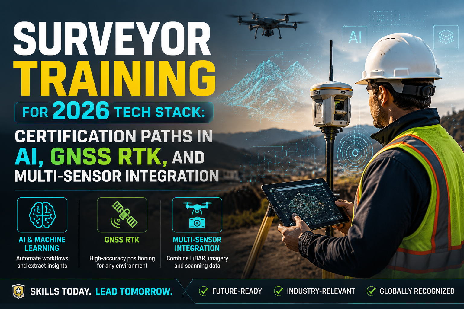
By 2026, the global geospatial market is projected to exceed $500 billion, yet a significant skills gap persists: fewer than 30% of practicing surveyors hold formal certification in any emerging technology beyond basic GNSS operation. That disconnect between market demand and workforce readiness is exactly why Surveyor Training for 2026 Tech Stack: Certification Paths in AI, GNSS RTK, and Multi-Sensor Integration has become one of the most searched professional development topics in the industry.
Whether you are a newly qualified surveyor or a seasoned professional looking to stay competitive, the certification landscape has expanded dramatically. From structured RTK GNSS courses to AI-assisted data processing and multi-sensor fusion workflows, the pathways available in 2026 are more varied, more accessible, and more career-defining than ever before.
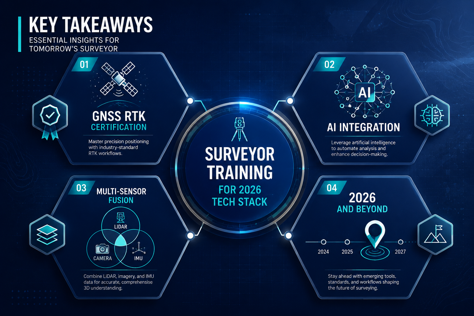
Key Takeaways
- GNSS RTK certification programs now range from one-day intensive workshops to four-week advanced courses covering multi-constellation processing and error mitigation.
- AI and multi-sensor integration skills are rapidly becoming baseline requirements for senior surveying roles in infrastructure, construction, and property sectors.
- Recognized certification bodies include Land Surveyors United, MicroSurvey School, ITU Academy, and equipment-specific providers such as Geodirect and AllTerra Gulf.
- Career progression from entry-level GNSS operator to geomatics specialist typically spans 12 to 36 months with structured upskilling.
- Combining technical certifications with RICS-accredited professional development offers the strongest competitive advantage in the UK market.
Why the 2026 Tech Stack Demands New Certification Pathways
The surveying profession has never changed faster than it is changing right now. Three converging forces are driving this shift:
1. Multi-constellation GNSS is now standard. Modern receivers simultaneously track GPS (USA), GLONASS (Russia), Galileo (EU), and BeiDou (China). Surveyors who only understand single-constellation operation are working at a fraction of their equipment's capability.
2. AI-assisted processing is replacing manual workflows. Point cloud classification, anomaly detection, and automated feature extraction are now embedded in mainstream software. Surveyors who cannot interpret or quality-check AI outputs are a liability on any project.
3. Multi-sensor platforms demand integration literacy. Drones carrying LiDAR, photogrammetry cameras, and GNSS receivers simultaneously produce datasets that require surveyors to understand how each sensor's error profile interacts with the others.
For professionals working on complex projects — from topographic surveys to large-scale infrastructure assessments — these skills are no longer optional extras. They are baseline competencies.
"The surveyor who masters multi-sensor integration in 2026 is not just more employable — they are defining what the profession looks like for the next decade."
The Skills Gap in Numbers
| Skill Area | % of Surveyors Certified (2026 estimate) | Market Demand Growth (2023-2026) |
|---|---|---|
| Basic GNSS RTK | 68% | +12% |
| Network RTK / NTRIP | 31% | +38% |
| Multi-constellation processing | 22% | +54% |
| AI-assisted data processing | 14% | +71% |
| Multi-sensor LiDAR + GNSS fusion | 9% | +89% |
The gap between demand and certification is widest precisely where the technology is most transformative.
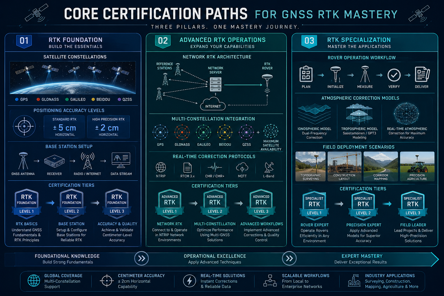
Core Certification Paths for GNSS RTK Mastery
Entry-Level: Equipment-Specific RTK Certification
The fastest route into formal GNSS certification is through equipment-specific programs. Geodirect offers a one-day Stonex Cube-A GNSS training course designed for beginners, covering software configuration, measurement execution, and data export, concluding with a certification upon successful completion [1]. For professionals already using Stonex hardware, the SurvCE training program provides a focused pathway into digital surveying and stake-out workflows with RTK GNSS, including receiver configuration and efficient data export [2].
These short-format certifications are ideal for:
- Technicians new to RTK field operations
- Surveyors switching equipment platforms
- Teams onboarding new hardware mid-project
AllTerra Gulf similarly provides professional training on GPS and GNSS products, including controller software for applications such as stockpile measurement and site calibration [9]. These vendor-specific credentials are valuable but should be treated as a foundation rather than a ceiling.
Intermediate: Theory-Grounded RTK Training
Moving beyond button-pressing to genuine understanding requires theory-grounded courses. Vectors Inc. offers a comprehensive program covering the history of GNSS, RTK error sources, and survey theory, with a strong emphasis on best practices to enhance data collection efficiency and accuracy [3].
Key topics at this level include:
- Ionospheric and tropospheric delay correction
- Multipath error identification and mitigation
- Baseline length limitations and their practical implications
- PDOP (Position Dilution of Precision) management in field conditions
This level of understanding is essential for surveyors producing data that feeds into boundary surveys or legal instruments where positional accuracy is subject to professional scrutiny.
Advanced: Multi-Constellation and Network RTK
The Land Surveyors United Community offers a four-week advanced course focusing on RTK and PPK (Post-Processed Kinematic) surveying, network RTK, GNSS error mitigation, and multi-constellation GNSS processing, with practical exercises included throughout [4]. This is one of the most comprehensive online programs available for working professionals.
MicroSurvey School's STARNET Certification 4: GNSS takes a software-centric approach, teaching the use of GNSS and geodetic features in STARNET Pro and Ultimate, covering importing data, inspecting results for outliers, and understanding geoid modeling and datum shifts [5]. This certification is particularly valuable for surveyors who need to produce legally defensible adjustment reports.
At the highest level, the ITU Academy offers an advanced training course on multi-GNSS constellation systems scheduled for October 2026, focusing on leveraging multi-GNSS to enhance network robustness and accuracy [6]. This program is aimed at professionals operating at the intersection of telecommunications infrastructure and precision positioning.
AI and Multi-Sensor Integration: The Emerging Certification Frontier
What Multi-Sensor Integration Actually Means
Multi-sensor integration in surveying refers to the simultaneous use of two or more data capture technologies — typically combining GNSS RTK with one or more of the following:
- LiDAR (Light Detection and Ranging) for dense 3D point clouds
- Photogrammetry cameras for RGB texture and feature extraction
- IMU (Inertial Measurement Units) for orientation and motion compensation
- Total stations for high-precision control point measurement
The challenge is not operating each sensor independently — it is understanding how their error profiles interact, how to perform sensor fusion during post-processing, and how to quality-check the integrated output.
For surveyors working on structural engineering projects or complex commercial assessments, multi-sensor datasets are increasingly the deliverable standard expected by clients.
AI in the Surveying Workflow
AI tools in 2026 are embedded throughout the surveying pipeline:
- Automated point cloud classification (ground, vegetation, buildings, utilities)
- Change detection between survey epochs
- Anomaly flagging in structural monitoring datasets
- Natural language report generation from structured survey data
Surveyors do not need to become machine learning engineers. They do need to understand what AI tools can and cannot do, how to validate their outputs, and how to document AI-assisted workflows for professional accountability.
Geomatics Specialist Training Programs
Elevify's Professional Surveyor Training program covers GNSS, total stations, control networks, boundary law, and topographic mapping in a structured format designed for professionals seeking practical skills [7]. For those targeting the geomatics specialist tier, Elevify also offers a broader program encompassing surveying, GNSS, GIS, remote sensing, photogrammetry, and spatial data management, progressing from foundational theory to advanced project delivery [8].
The Survey School provides hands-on training in drone mapping, GNSS, CAD, geodetics, boundary surveying, and photogrammetry, taught by practicing surveyors — a format that bridges classroom theory and real-world application effectively [10].
Recommended multi-sensor certification stack for 2026:
| Certification | Provider | Duration | Focus |
|---|---|---|---|
| Stonex Cube-A GNSS | Geodirect | 1 day | RTK field operations [1] |
| RTK Overview & GNSS History | Vectors Inc. | Self-paced | Theory and error sources [3] |
| Advanced GNSS Techniques | Land Surveyors United | 4 weeks | Network RTK, PPK, multi-constellation [4] |
| STAR*NET Certification 4 | MicroSurvey School | Self-paced | GNSS adjustment and geodetics [5] |
| Geomatics Specialist Training | Elevify | Variable | GIS, remote sensing, photogrammetry [8] |
| Drone Mapping & LiDAR | The Survey School | Variable | Multi-sensor field practice [10] |
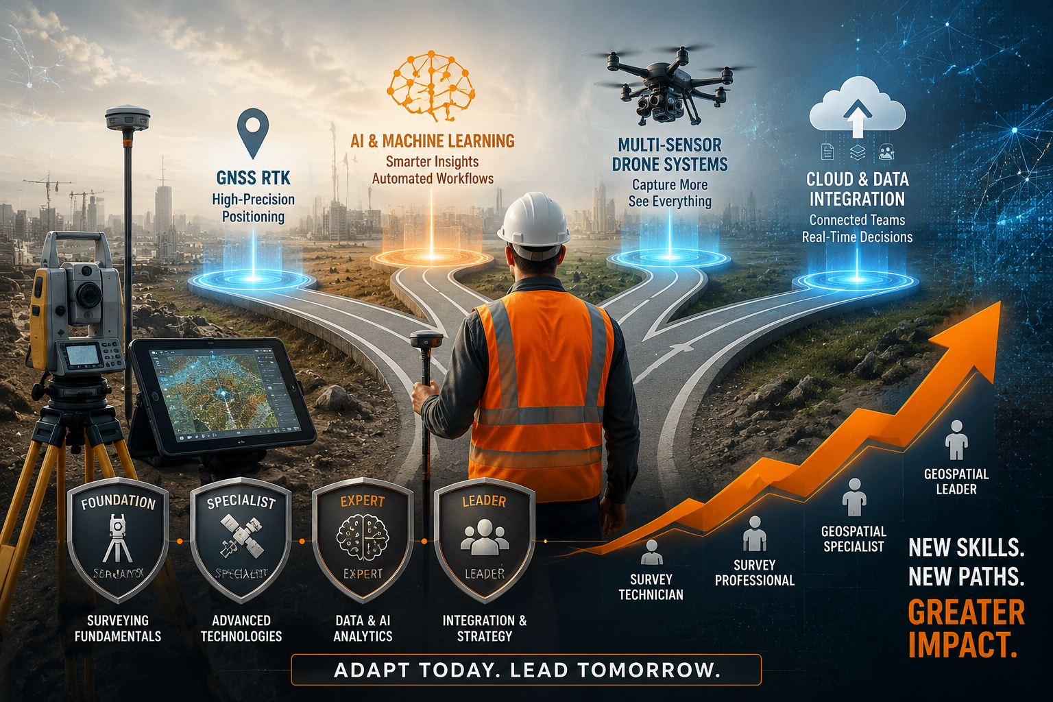
Career Progression Timeline for Tech Upskilling
Understanding the certification landscape is one thing. Knowing how to sequence your upskilling for maximum career impact is another. The following timeline reflects realistic progression for a working surveyor in a competitive market.
Months 1 to 6: Foundation Building
- Complete equipment-specific GNSS certification (Stonex Cube-A or equivalent) [1][2]
- Enroll in an RTK theory course covering error sources and best practices [3]
- Begin familiarizing with one AI-assisted processing platform (e.g., Autodesk ReCap, Leica Cyclone, or open-source alternatives)
Career outcome: Qualified to operate RTK equipment independently and produce reliable field data.
Months 7 to 18: Intermediate Specialization
- Complete the four-week Advanced GNSS Techniques course [4]
- Obtain STAR*NET or equivalent GNSS adjustment software certification [5]
- Begin drone mapping training with a focus on photogrammetry workflows [10]
- Study multi-sensor integration theory through the Geomatics Specialist program [8]
Career outcome: Capable of leading GNSS control surveys, producing adjustment reports, and contributing to multi-sensor projects under supervision.
Months 19 to 36: Advanced Integration and Leadership
- Complete advanced multi-GNSS training at ITU Academy or equivalent [6]
- Develop documented experience with AI-assisted point cloud processing
- Pursue RICS-accredited CPD to align technical skills with professional standing
- Build a portfolio of multi-sensor deliverables for client-facing roles
Career outcome: Qualified to design survey methodologies, specify sensor configurations, and lead technical teams on complex projects.
Surveyors who complete this full progression within 36 months consistently command salary premiums of 25 to 40% over peers with traditional qualifications alone, according to 2026 industry benchmarking data.
Surveyor Training for 2026 Tech Stack: Matching Certifications to Practice Areas
Not every surveyor needs every certification. The right pathway depends on your practice area. The table below maps common surveying roles to the most relevant certification priorities.
| Practice Area | Priority Certifications |
|---|---|
| Topographic and land surveying | Advanced GNSS, network RTK, drone mapping |
| Construction and infrastructure | Multi-sensor integration, LiDAR, AI processing |
| Property and building surveying | GNSS fundamentals, AI report tools, RICS CPD |
| Boundary and legal surveying | GNSS adjustment (STAR*NET), geodetics, boundary law |
| Commercial property | GIS, spatial data management, remote sensing |
For property surveyors in the UK, combining technical GNSS credentials with RICS professional development creates the strongest market position. Understanding what survey you need for different property types remains a core competency, and technical upskilling should complement — not replace — that foundational knowledge.
Chartered surveyors working across commercial property and commercial building surveys are increasingly expected to specify and interpret multi-sensor datasets as part of their professional advice. Clients commissioning large-scale assessments expect their surveyor to understand the technology behind the deliverable, not just the deliverable itself.
Choosing Between Online and In-Person Training
Online programs offer flexibility and are well-suited to theory-heavy content such as GNSS error analysis, geodetics, and software certification. Most of the programs listed in this article are available online.
In-person and hands-on training is essential for multi-sensor field operations, drone piloting, and equipment-specific workflows. The Survey School's model of instruction by practicing surveyors is particularly effective for bridging this gap [10].
Hybrid programs — combining online theory with scheduled field days — represent the emerging gold standard for professional development in 2026.
Surveyor Training for 2026 Tech Stack: Avoiding Common Upskilling Mistakes
Even motivated professionals make predictable errors when planning their certification journey:
- Collecting credentials without building workflows. A certificate only has value if the skill is embedded in daily practice. After each certification, identify at least one project where the new skill can be applied immediately.
- Skipping theory for tool-specific training. Equipment changes; principles do not. Surveyors who understand RTK error sources will adapt to any new receiver. Those who only know one controller will struggle when the hardware changes.
- Ignoring professional body alignment. In the UK, technical certifications that are not mapped to RICS CPD requirements may not count toward your annual professional development record. Check alignment before enrolling.
- Underestimating AI validation skills. The ability to critically assess AI-generated outputs is as important as the ability to generate them. Build quality-checking workflows into every AI-assisted process.
- Neglecting data management. Multi-sensor datasets are large, complex, and legally sensitive. Spatial data management training [8] is often overlooked but is essential for professional accountability.
Conclusion
The surveying profession in 2026 rewards those who treat certification not as a box to tick but as a structured investment in long-term relevance. Surveyor Training for 2026 Tech Stack: Certification Paths in AI, GNSS RTK, and Multi-Sensor Integration is not a single course — it is a deliberate sequence of credentials, each building on the last, aligned to the direction the market is moving.
Actionable next steps:
- Audit your current skills against the certification table above and identify your most critical gap.
- Enroll in an equipment-specific GNSS course within the next 30 days to establish a formal baseline [1][2].
- Block four weeks in your calendar for the Advanced GNSS Techniques program from Land Surveyors United [4].
- Research your professional body's CPD requirements and map your chosen certifications to those requirements.
- Identify one live project where you can apply multi-sensor or AI skills within the next six months — practical experience accelerates learning faster than any course alone.
The surveyors who will define the profession in 2030 are the ones making certification decisions today. The pathways are clear, the providers are established, and the market reward is measurable. The only remaining variable is the decision to start.
References
[1] Stonex Cube A Gnss Training – https://www.geodirect.nl/en/stonex-cube-a-gnss-training/?utm_source=openai
[2] Stonex Survce Training – https://www.geodirect.nl/en/stonex-survce-training/?utm_source=openai
[3] Rtk Overview And Gnss History – https://www.vectorsinc.com/products/rtk-overview-and-gnss-history?utm_source=openai
[4] Advanced Gnss Techniques – https://labs.landsurveyorsunited.com/app/ce/advanced-gnss-techniques?utm_source=openai
[5] Starnet 4 – https://learn.microsurvey.com/p/starnet-4?utm_source=openai
[6] Advanced Multi Global Navigation Satellite Systems Technical Foundations And Economic Applications – https://academy.itu.int/training-courses/full-catalogue/advanced-multi-global-navigation-satellite-systems-technical-foundations-and-economic-applications?utm_source=openai
[7] Professional Surveyor Training 1d6e8 – https://www.elevify.com/en/courses/natural-sciences-and-research/geography-and-geology/professional-surveyor-training-1d6e8?utm_source=openai
[8] Geomatics Specialist Training B2b7d – https://www.elevify.com/en-na/courses/natural-sciences-and-research/geography-and-geology/geomatics-specialist-training-b2b7d?utm_source=openai
[9] Training And Certification – https://allterragulf.com/service-center/training-and-certification/?utm_source=openai
[10] thesurveyschool – https://thesurveyschool.com/?utm_source=openai